Alpine Hike and a Dip in the Dragon's Lake

in #hive-19491327 days ago

Last week was one to escape Prague, gripped by what we Czechs consider a heatwave—though our perception is often somewhat exaggerated. To our defense, even my Prague-based Indian friends from Delhi and Hyderabad admitted they felt hot, blaming the high humidity. Since Czechs naturally love outdoor activities, especially at higher elevations, it was no surprise that my Spanish girlfriend and I decided to seek a haven in the Alps, the nearest real mountain range to Prague. For historical reasons, we call certain hills of less than 500 meters mountains. We spent the first few days in the Gastein area, which I have visited several times for skiing. With multiple hiking routes available, we even found one that offered a refreshing dip in a mountain lake at around 1,900 meters.

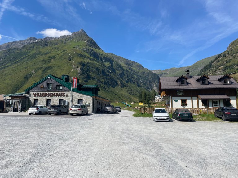
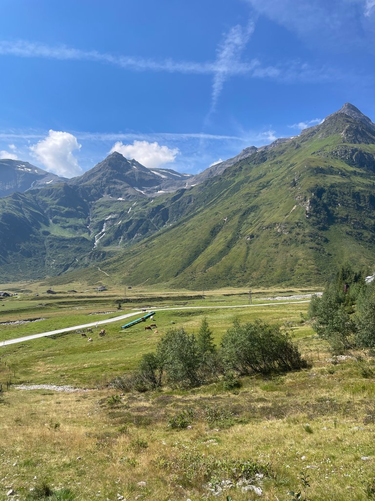
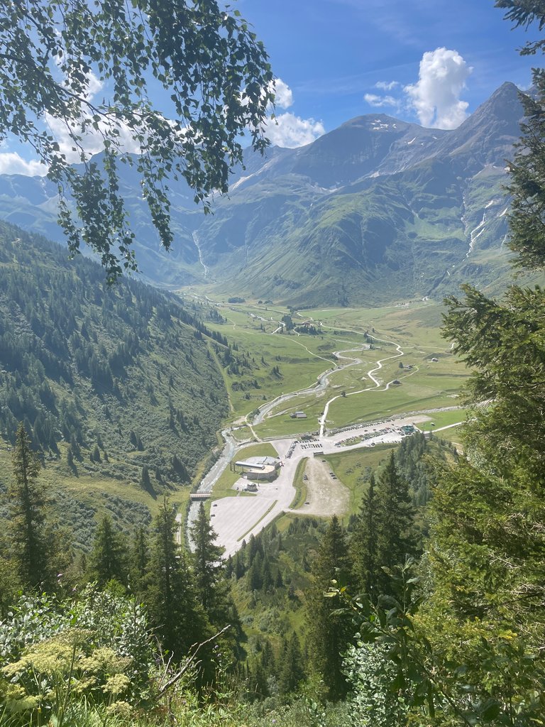
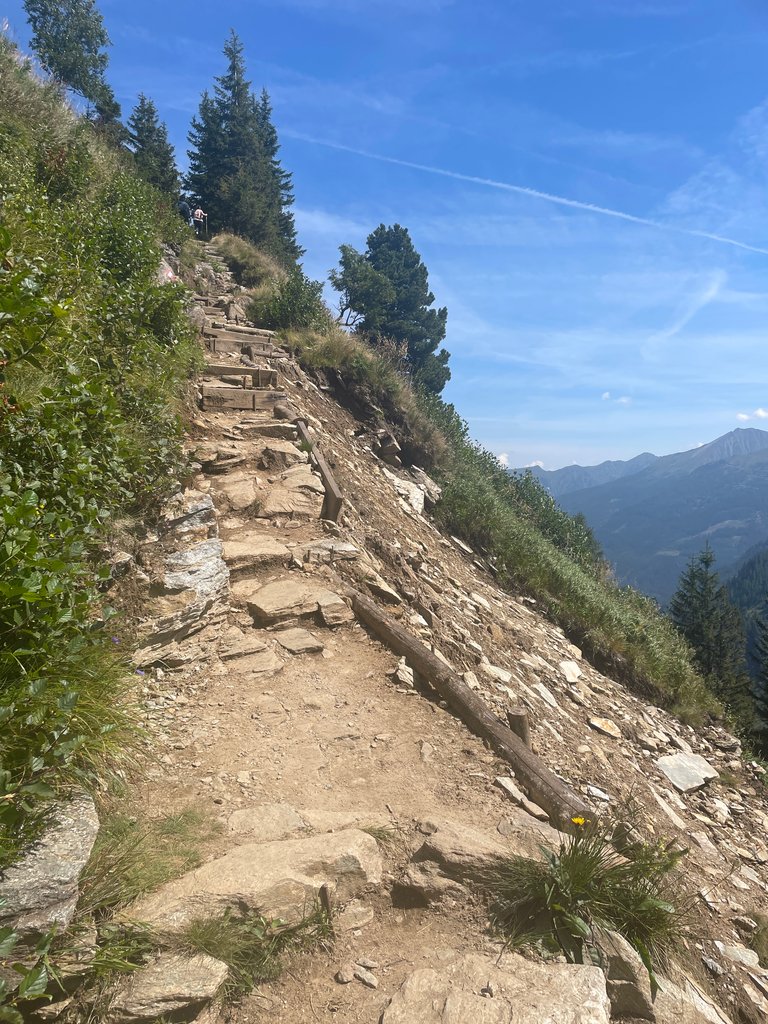
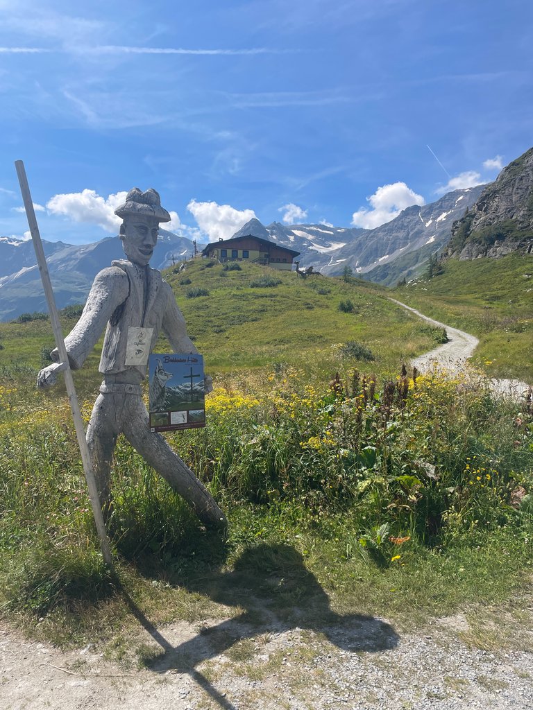
Leaving the car in Schloss Böckstein, an old mining village at the foot of Zitterauer Tisch (2,463 m), the highest peak we planned to climb that day, we initially intended to start our hike along a creek with several minor waterfalls. Unfortunately, the path was severely damaged by a recent thunderstorm, forcing us to walk the road instead. Eventually, we had to take a bus through a tunnel restricted to pedestrians and cyclists. This detour saved us a bit of time, covering two or three kilometers by bus, and brought us to the Sportgastein ski resort about 40 minutes ahead of schedule. From there, the hike began as we left the paved roads behind.

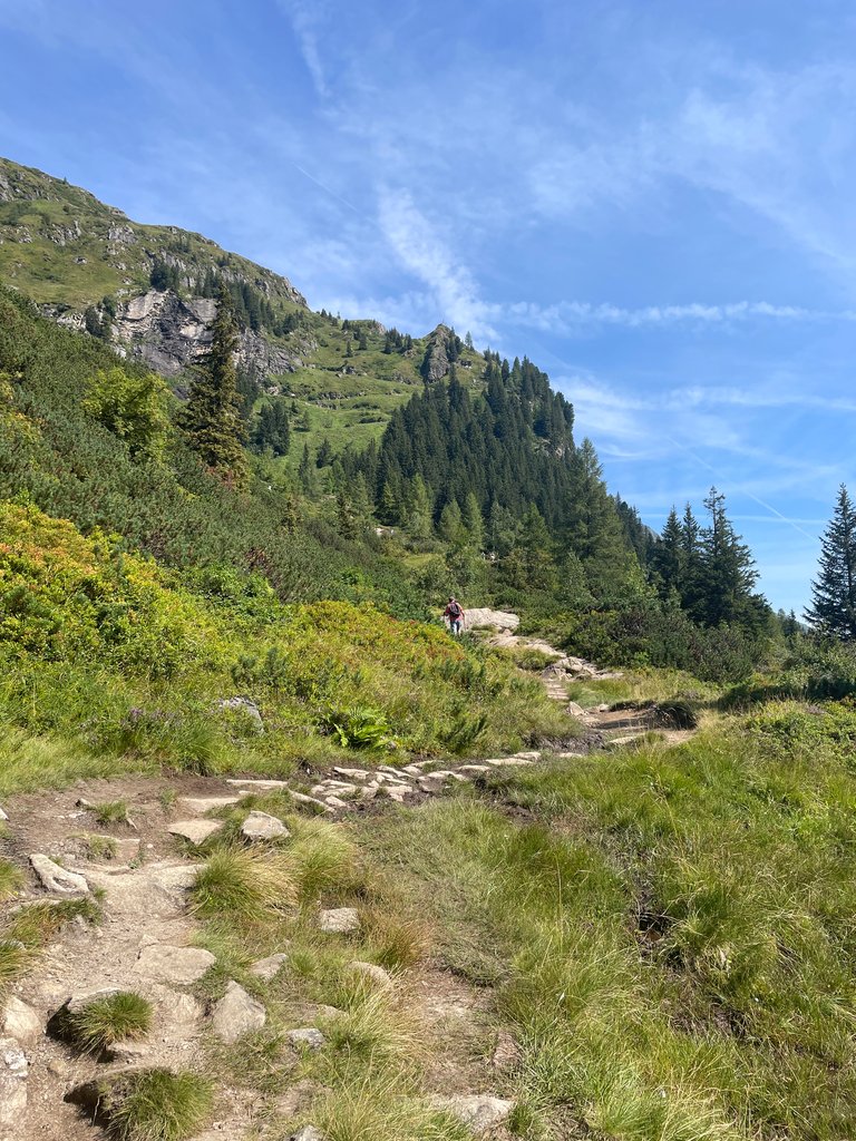
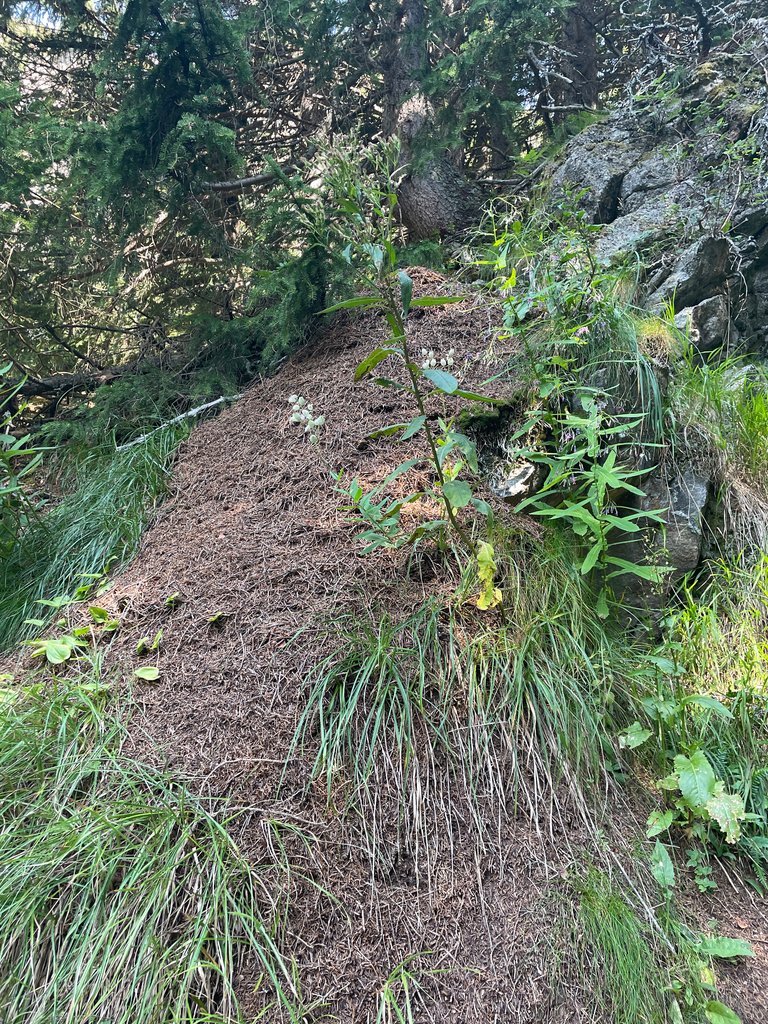
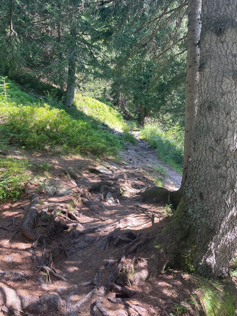
I was glad we could walk several hundred meters in a forest that offered shade—I admit my Spanish girlfriend is far more resistant to heat than I am. The woods in the Alps are healthy and full of wildlife, including some impressive ant nests—here’s one.


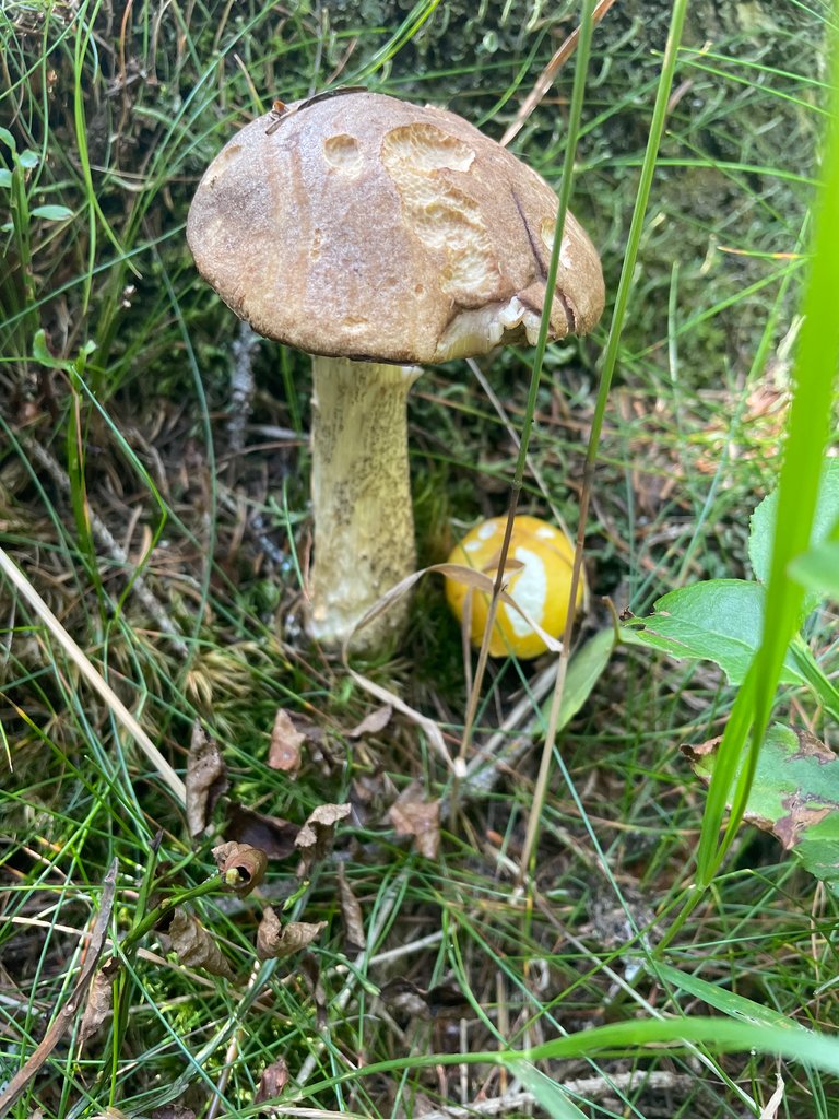
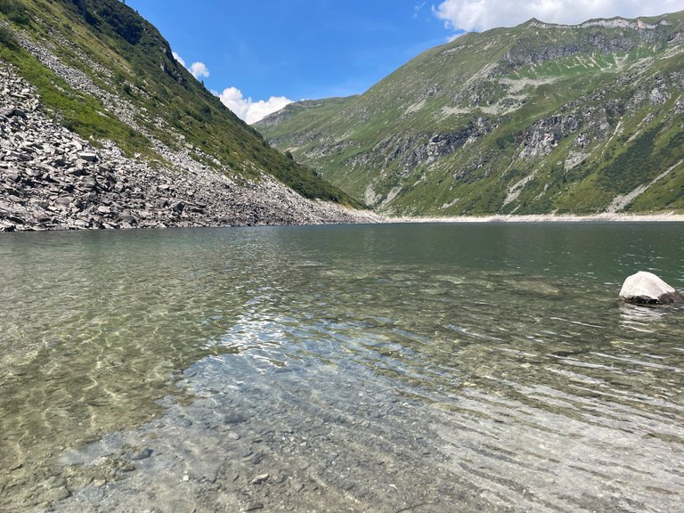
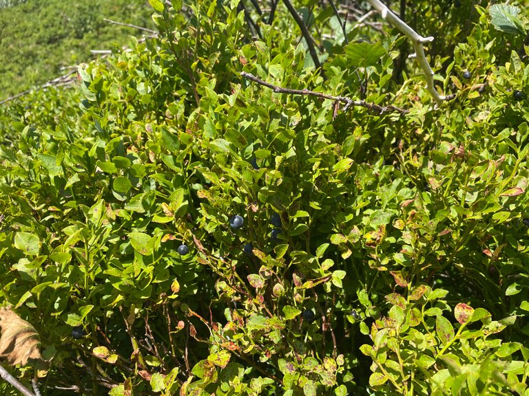
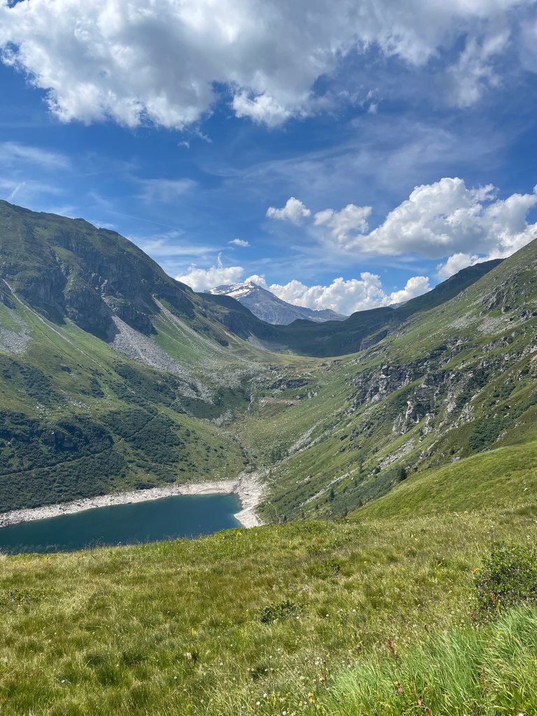
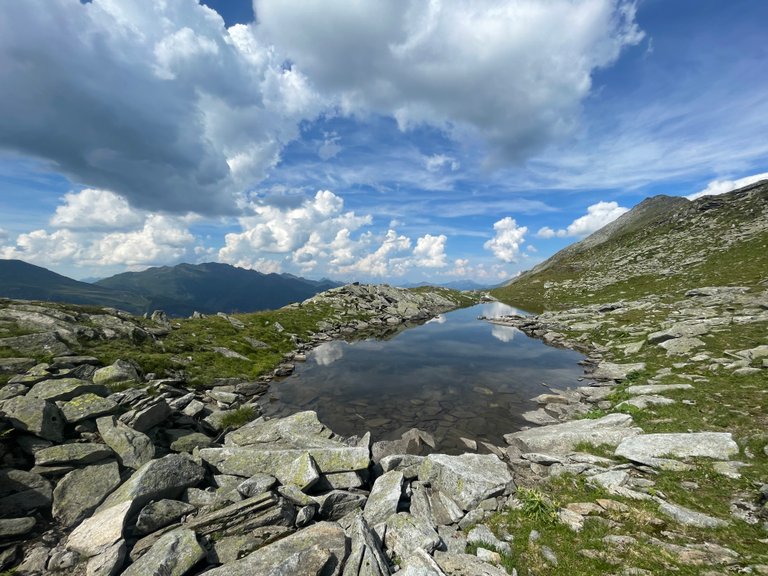
Once we passed the tree line at around 1,800 meters, we could at least feast on blueberries growing along the path. They were just ripe and quite refreshing. And then… we spotted a dragon guarding the lake. The famed Drache vom Bockhartsee. Do not climb on him!

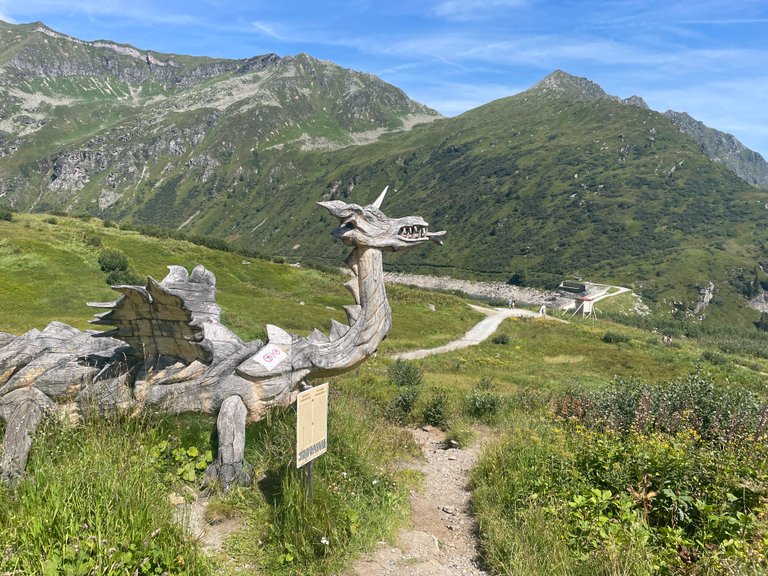
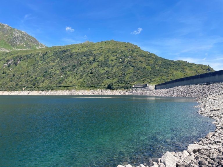
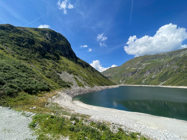
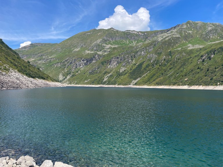
Unlike most of his kin, this dragon doesn’t speak—or at least didn’t find us worthy of conversation. Perhaps he’s intimidated by the shepherd hero approaching him from the lake. We had hoped to witness an epic battle, but the foes seemed content to wait for the other to make the first move. What brilliant strategies they must have been devising! So, we descended to the Bockhartsee, which is, in fact, a reservoir rather than a natural lake. Nevertheless, it’s well worth taking a dip in its crystal-clear water.

The Bockhartsee is refreshingly chilly, as you’d expect in the mountains. Despite the cold, it felt invigorating, and I’m pretty sure I’ve never swum at such a high altitude before. If you ever find yourself in this part of the Alps, I recommend bringing a towel.


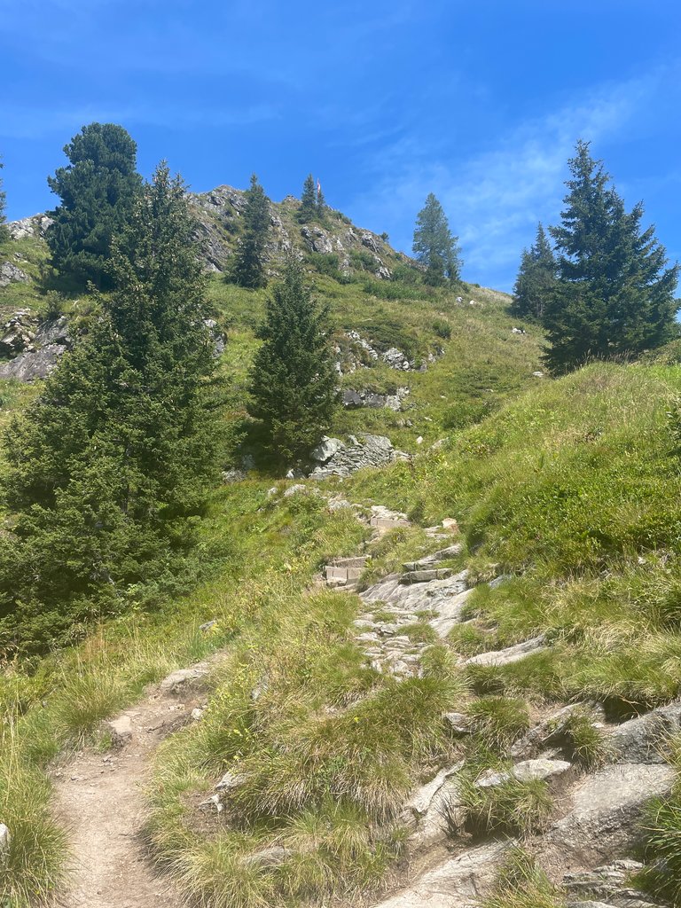
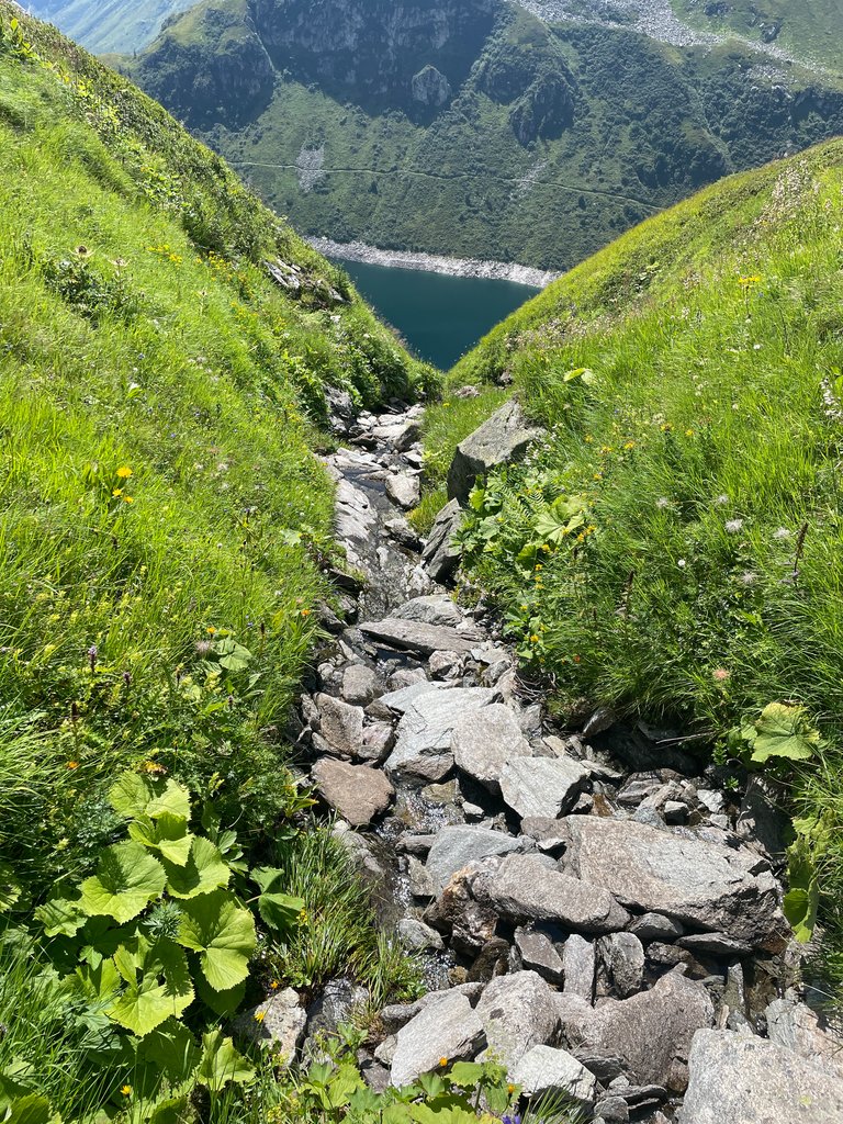
We couldn’t linger too long, as the entire hike was planned to take around 8 hours, and we still had about 700 meters to ascend to the highest peak. So, we pressed on, continuing among the blueberries and breathtaking views.


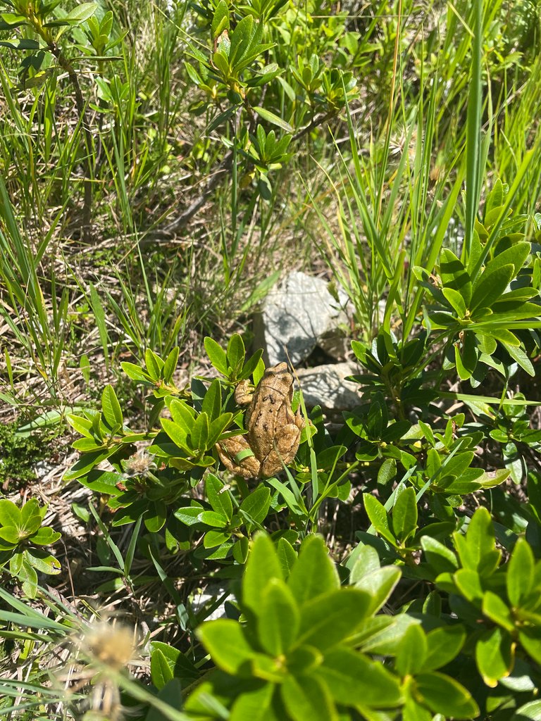
I mentioned earlier that the forest was brimming with life, and the plains above the tree line were no different. We encountered three snakes—too sneaky to be captured by my phone—along with many lizards, butterflies, and more. And then there was this frog, who was kind enough to pose for a photo. Given that there’s a dragon nearby, it might have been a cursed princess—who knows…

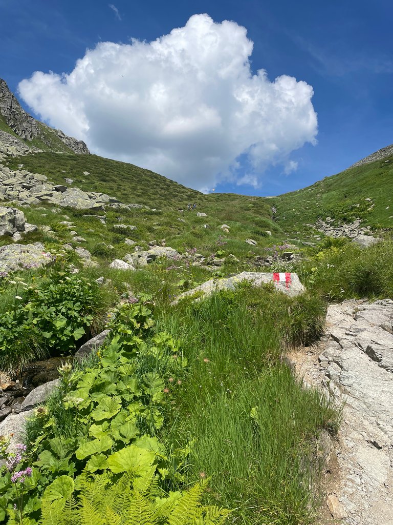
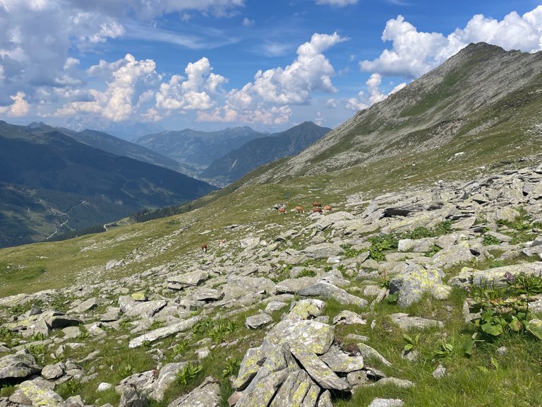
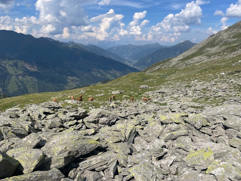
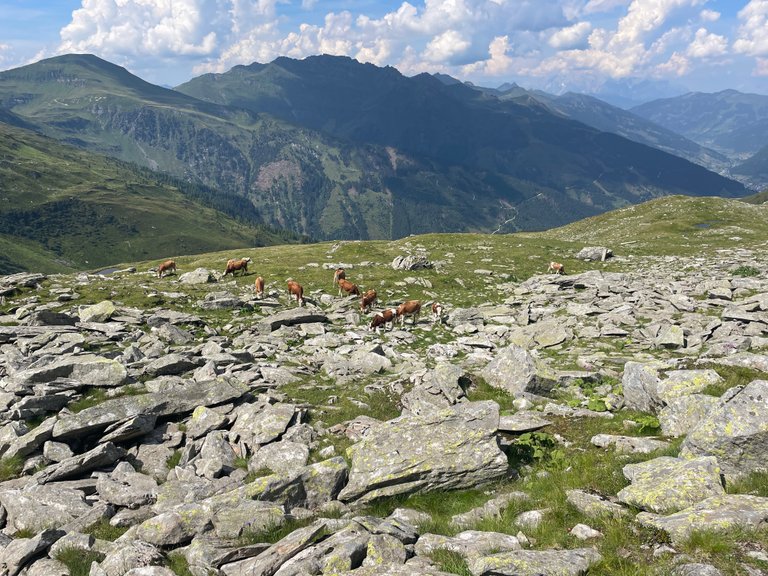
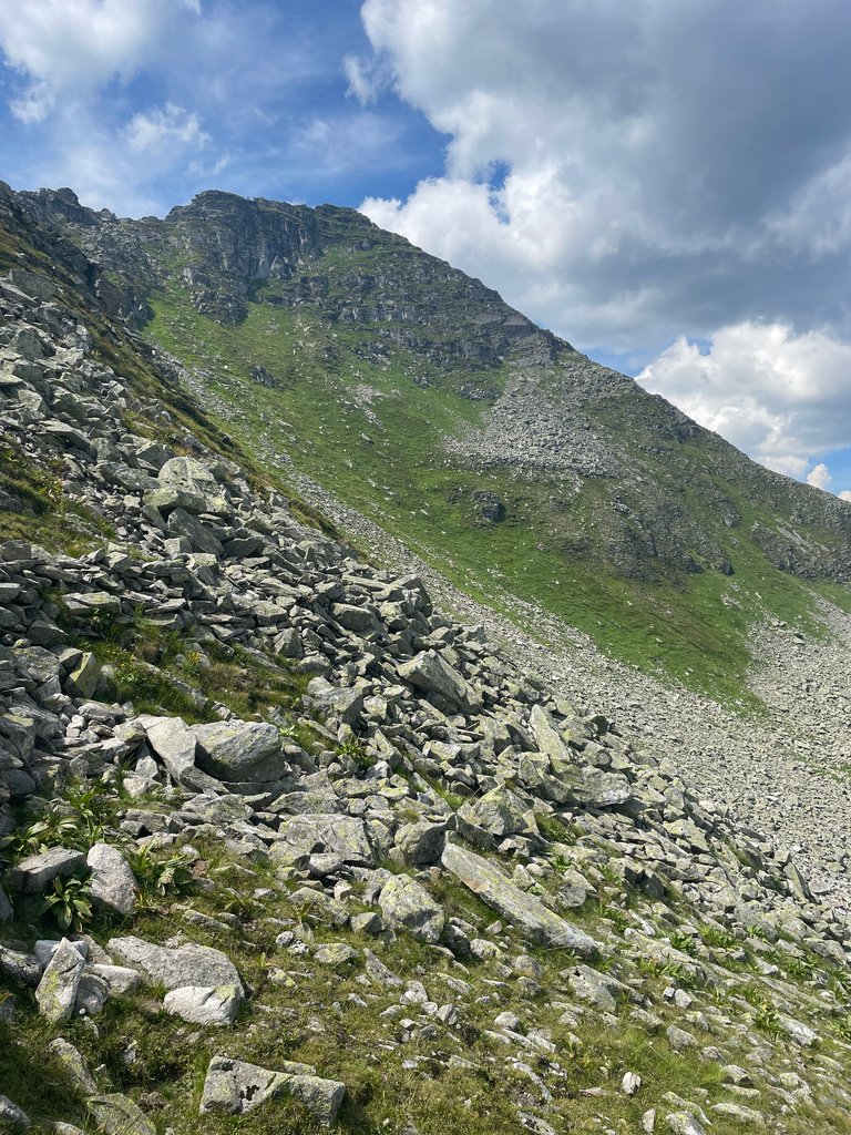
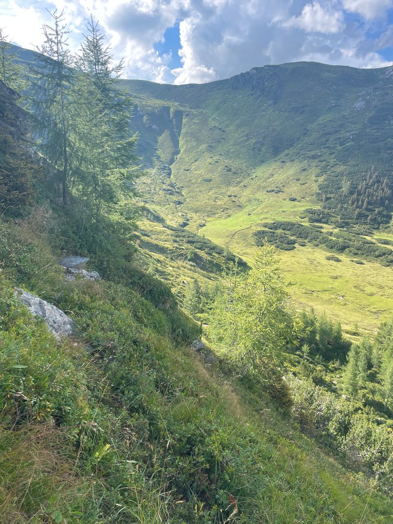
At around 2,200 meters, the path became rocky, eventually turning into a route over boulders. One might expect this to be the domain of wild mountain goats, but the distinct smell of dung suggested that other animals were feasting on the Alpine pastures. Yep, cows.


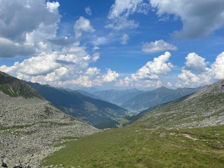
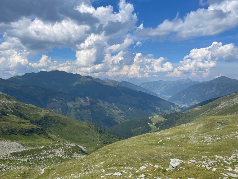
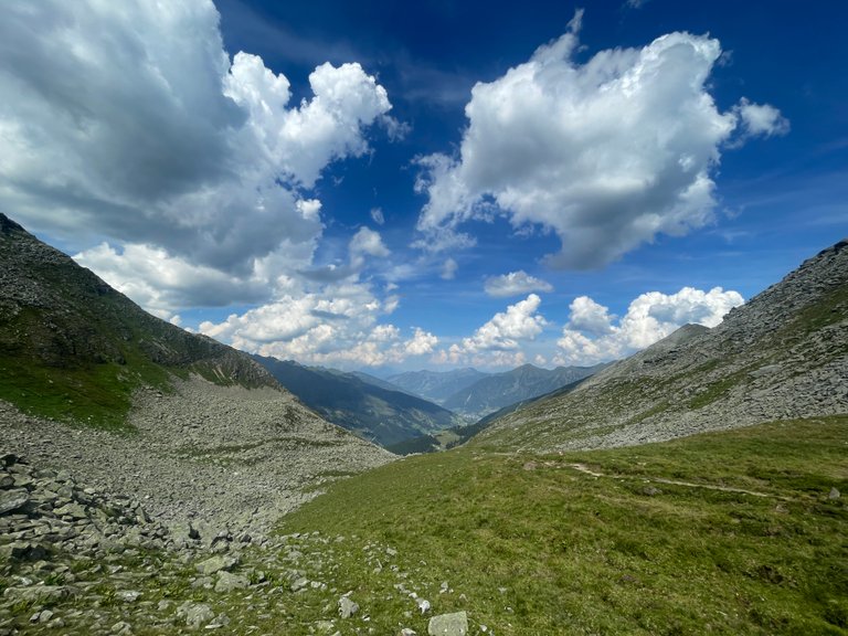
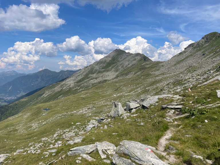
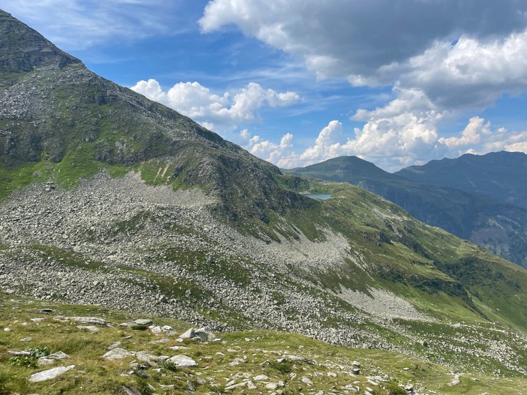
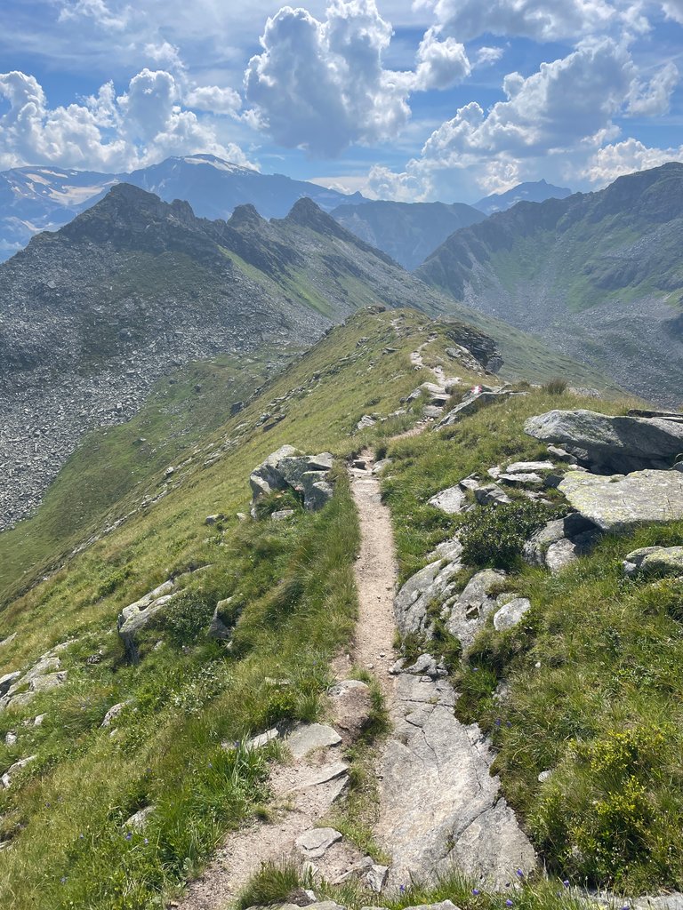
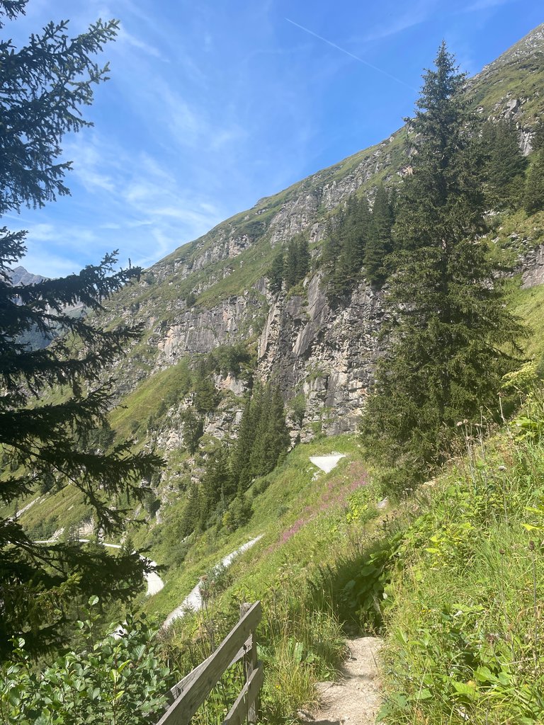
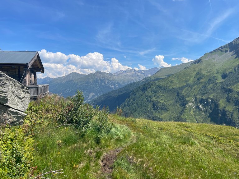
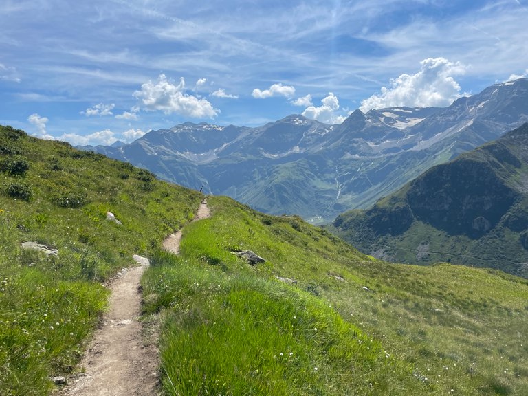
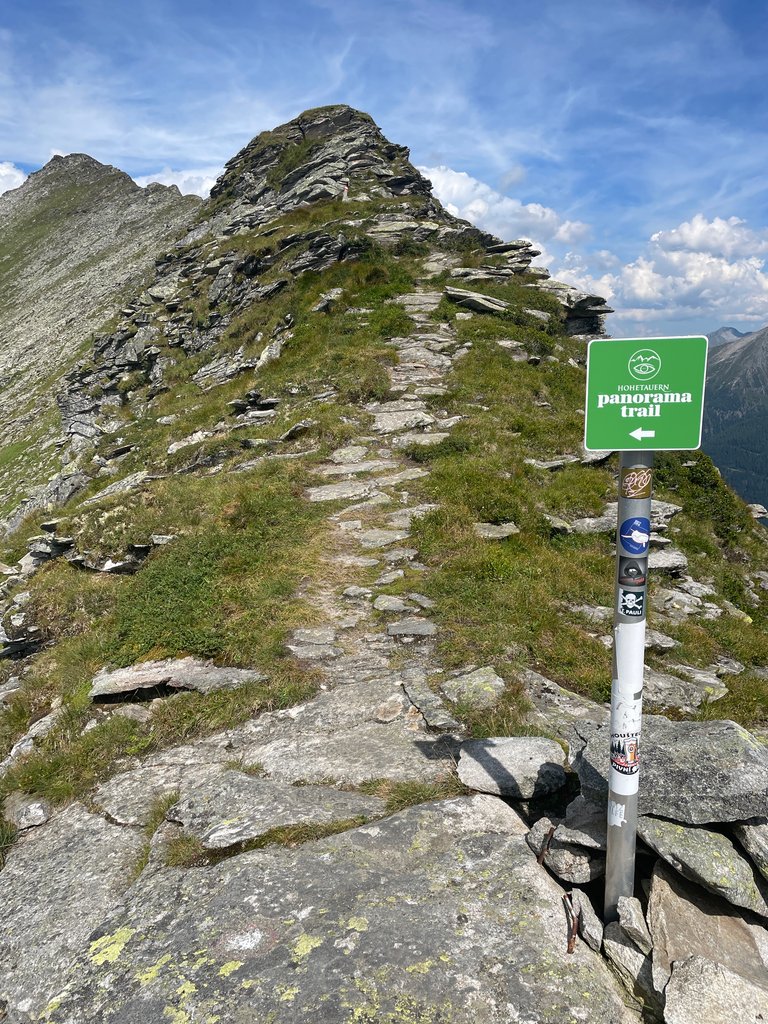
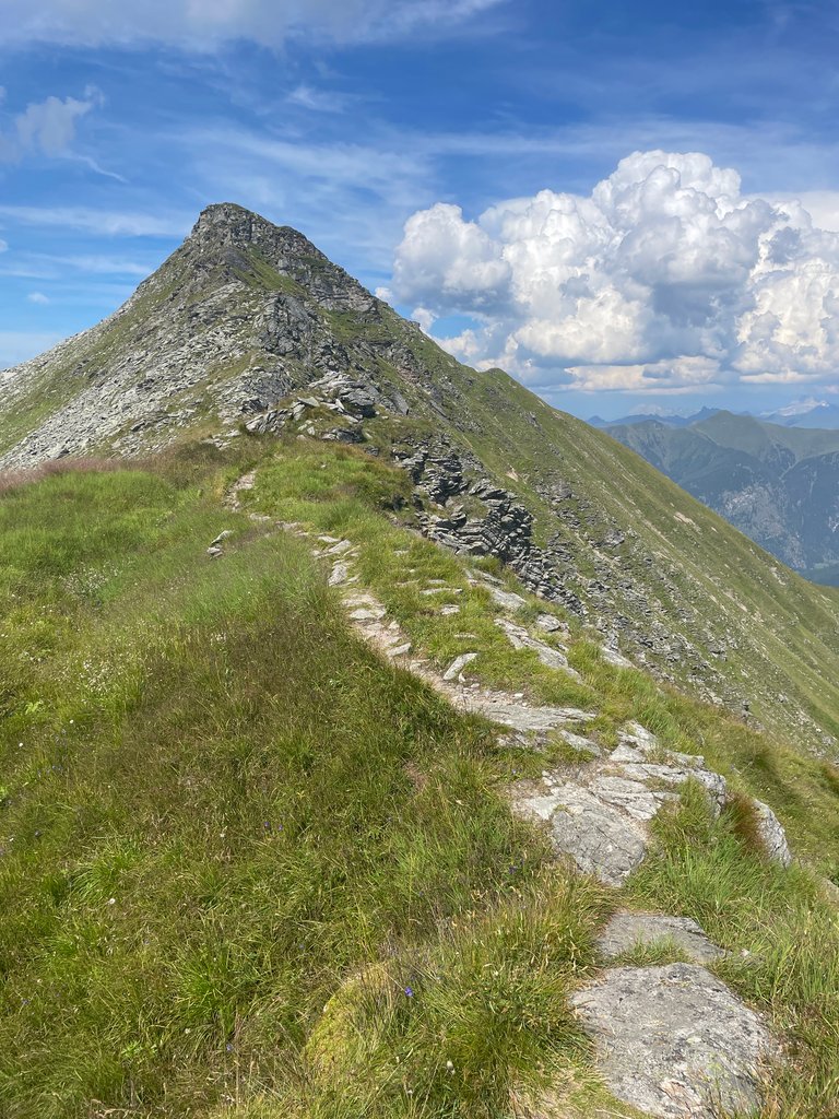
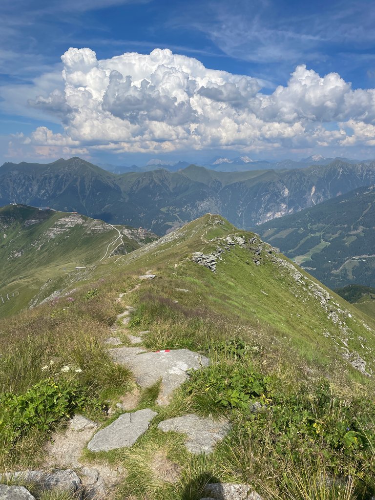
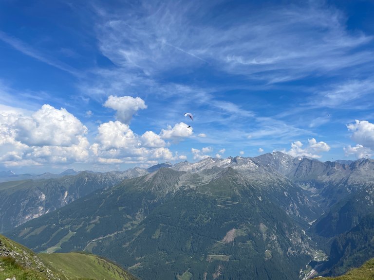
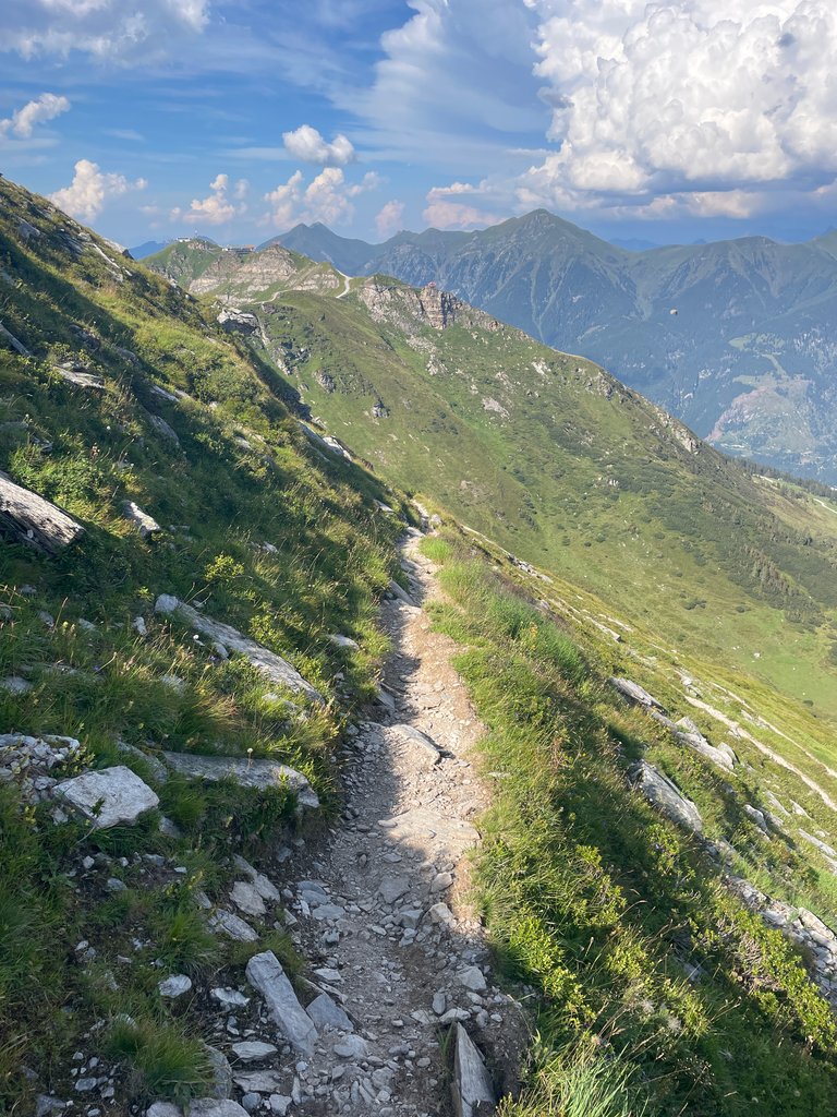
The most important decision of the day was still ahead of us, though. Should we take the Panorama Trail, which, surprisingly, doesn’t lead across the peaks, or should we tackle the more challenging path that goes directly over them? Naturally, we chose the latter.

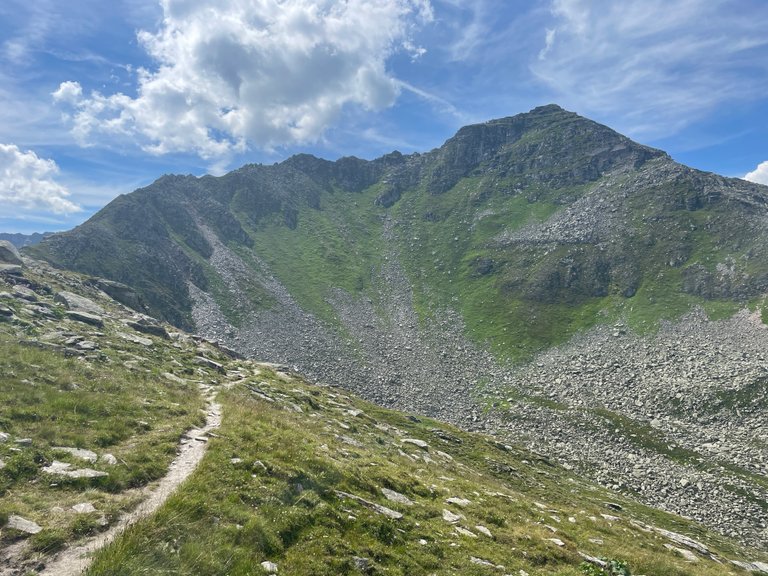
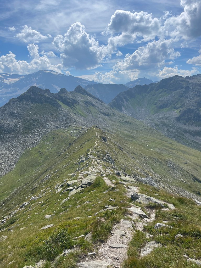
It might not be apparent from the pictures, but it was rather windy. Despite that, the path felt like something out of a fairy tale. We chose well indeed.


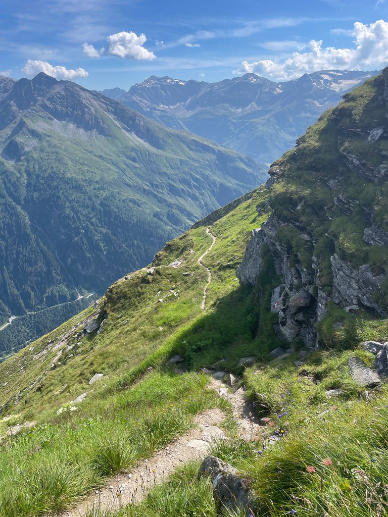
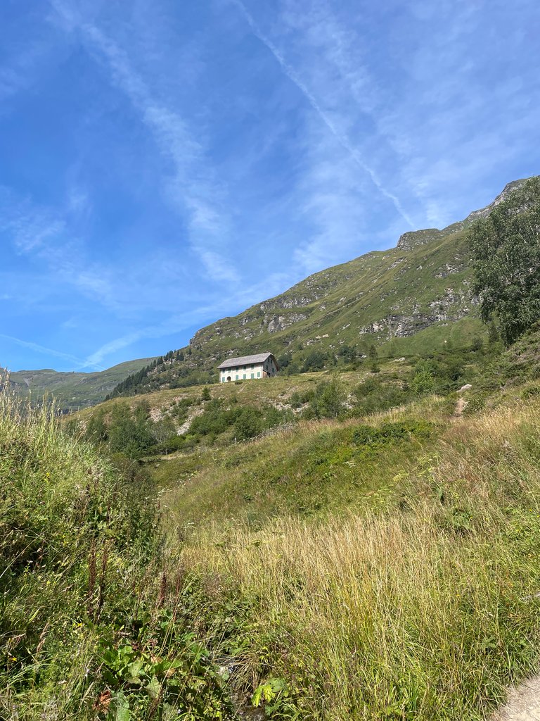
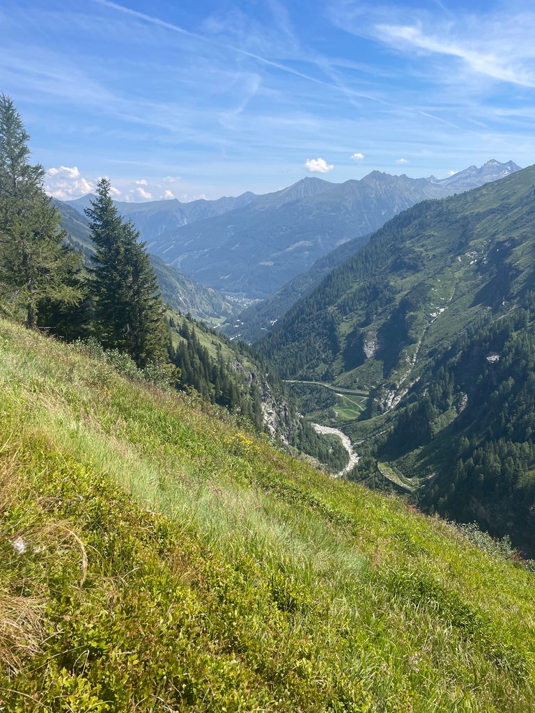
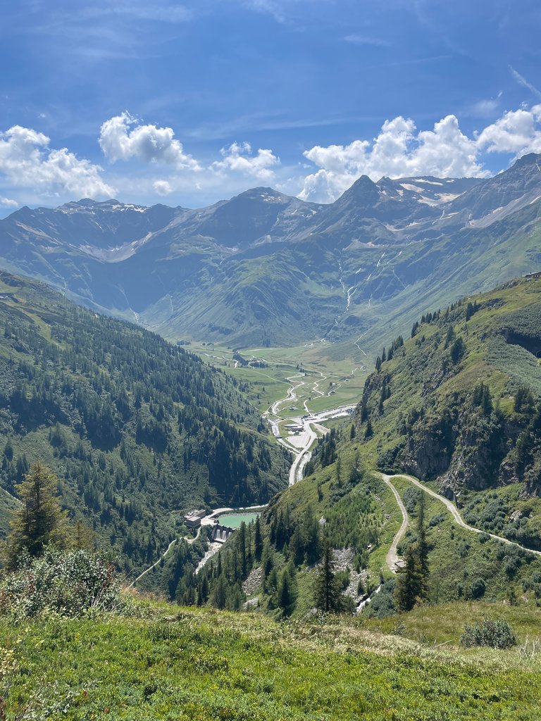
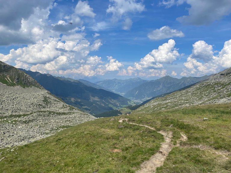
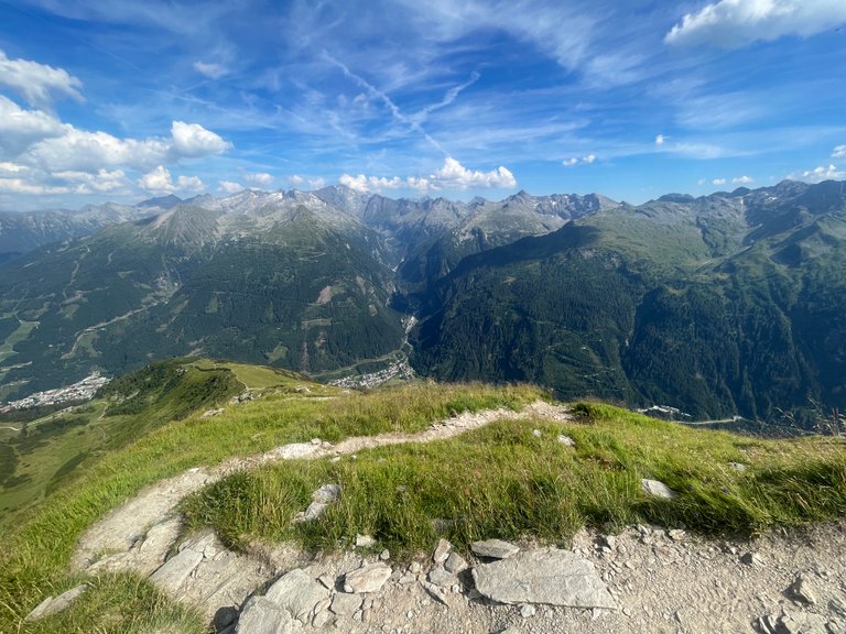
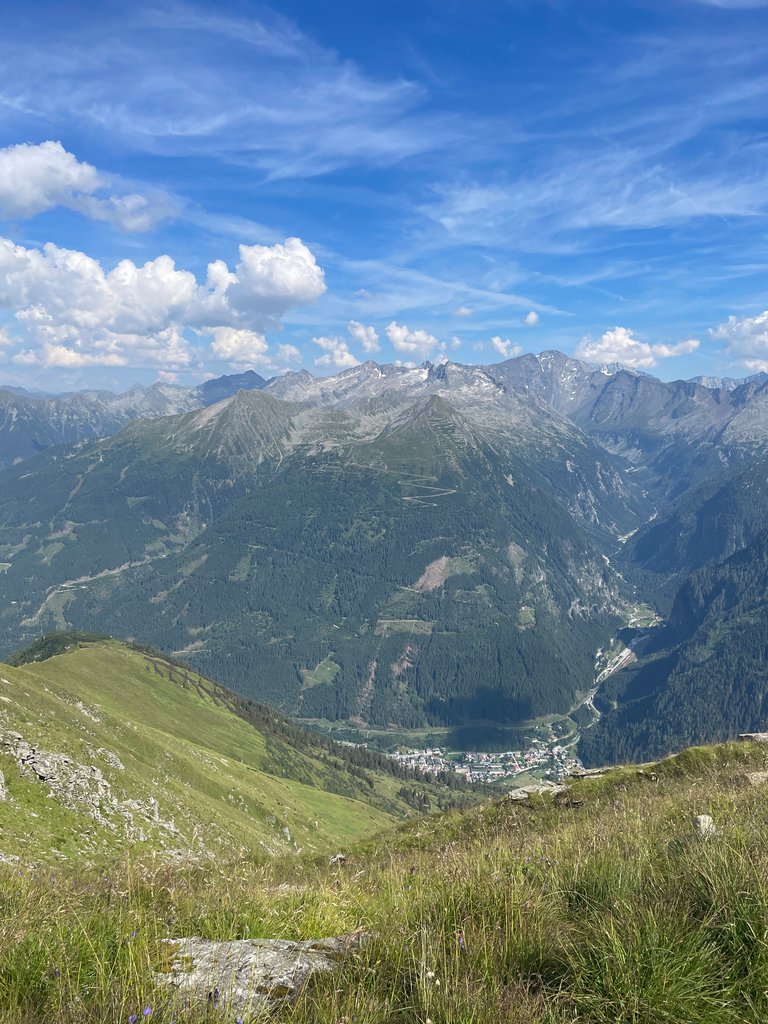
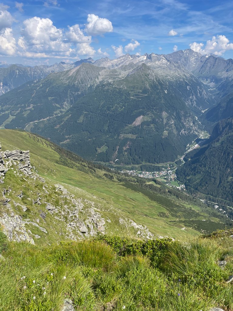
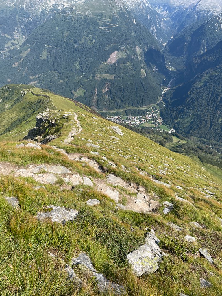
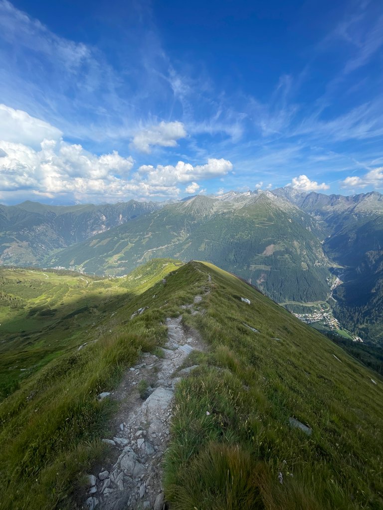
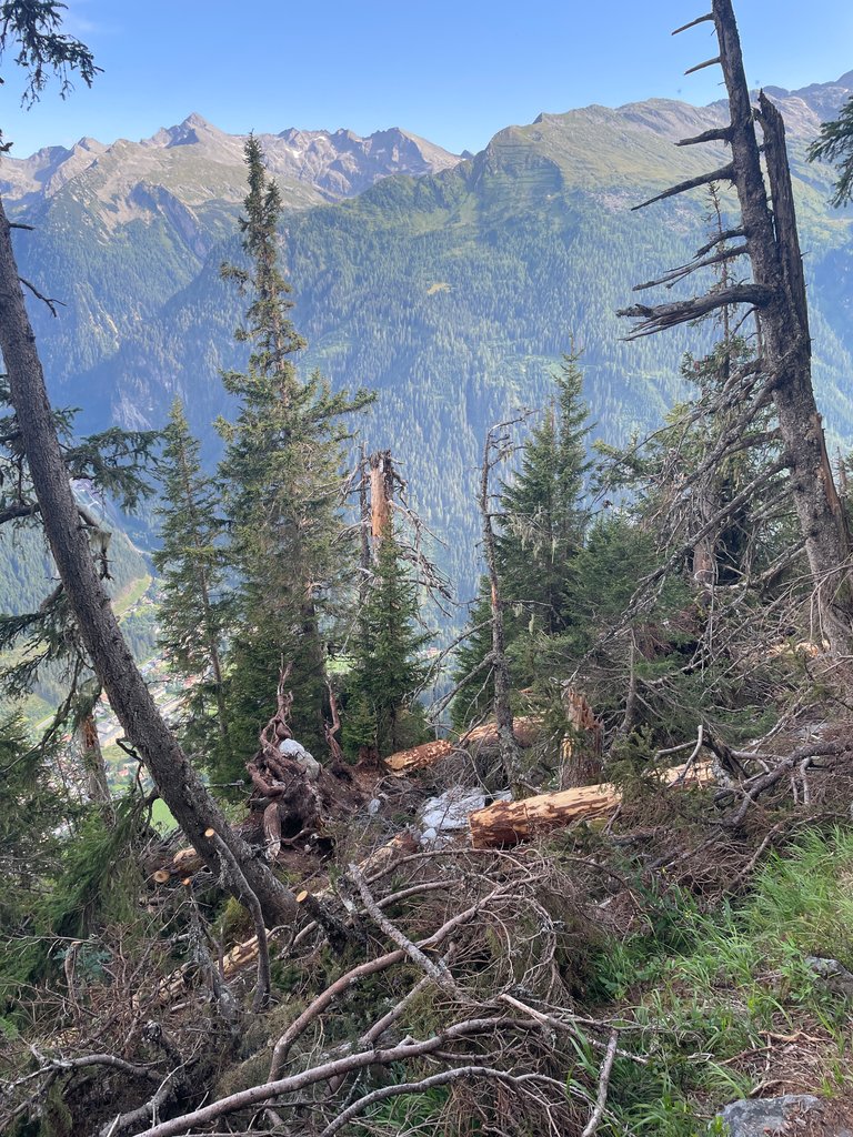
The village you can see in some pictures is Schloss Böckstein, where our hike began. It’s not far—just about 2.5 kilometers away. However, it’s around 1,300 meters below us, and that’s what the final part of our hike consisted of—a seemingly never-ending descent.


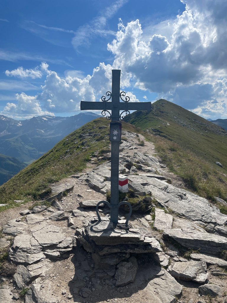
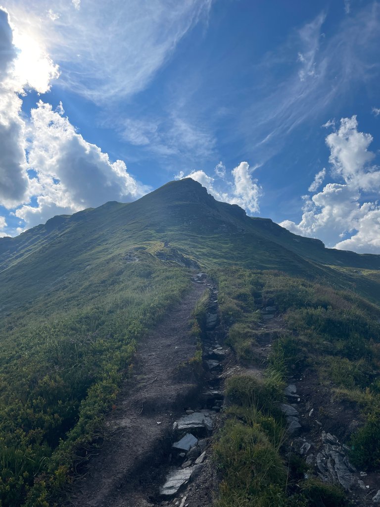
This cross adorns the peak of Tischkogel (2,409 m). Up to that point, the path had been fine. But then the steep descent started. See for yourself in the following shots.


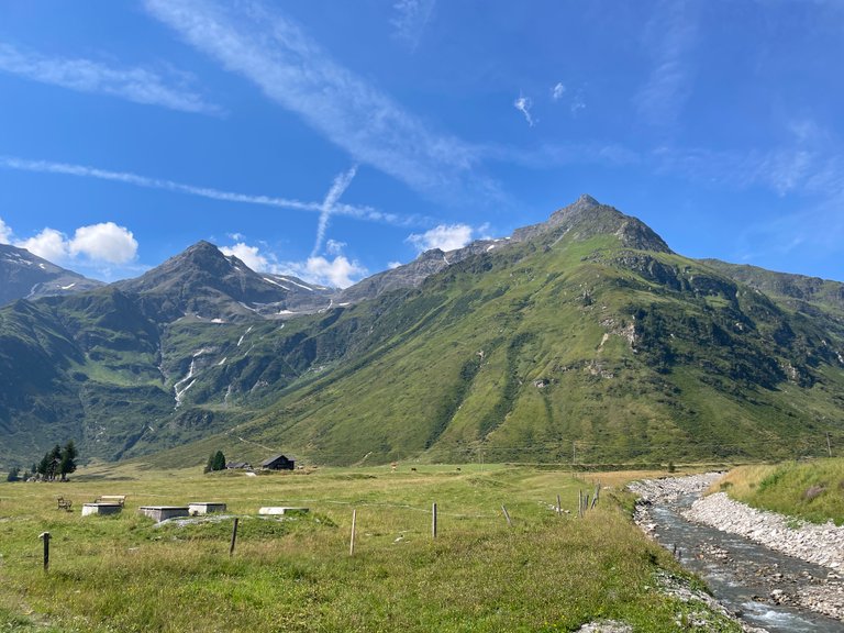
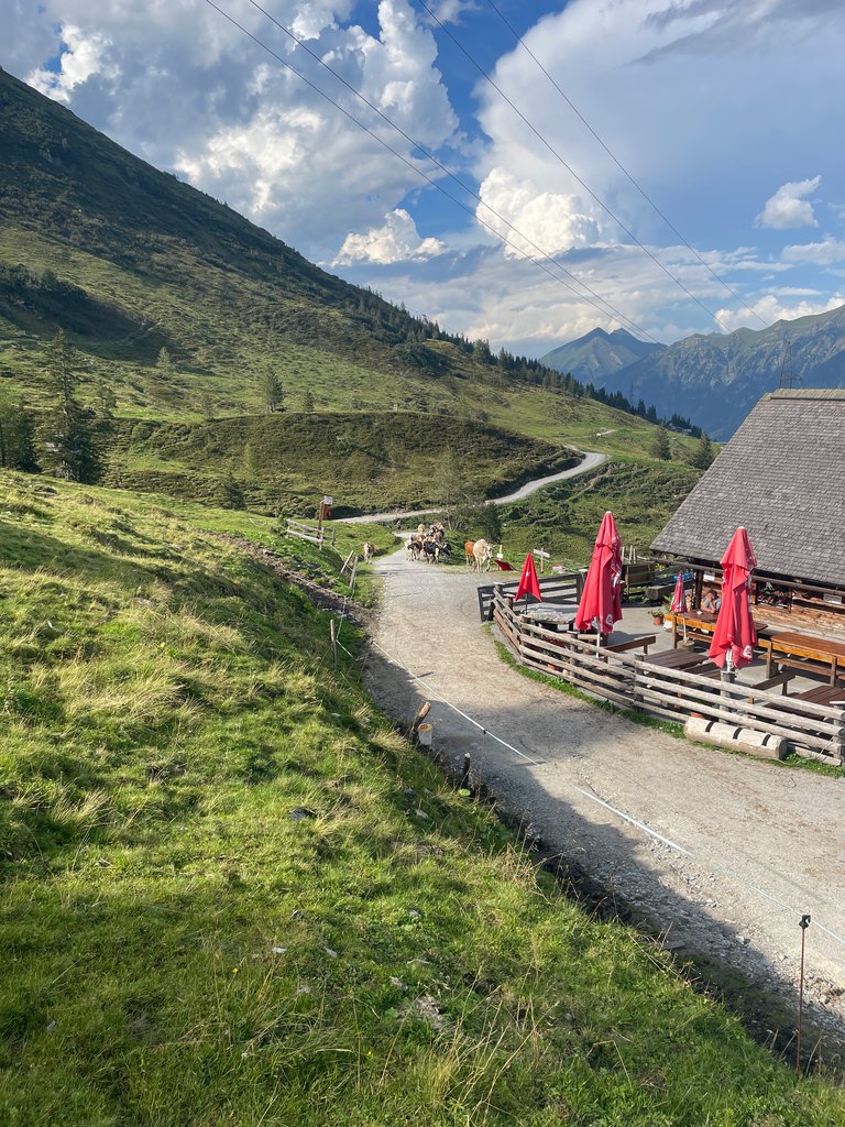
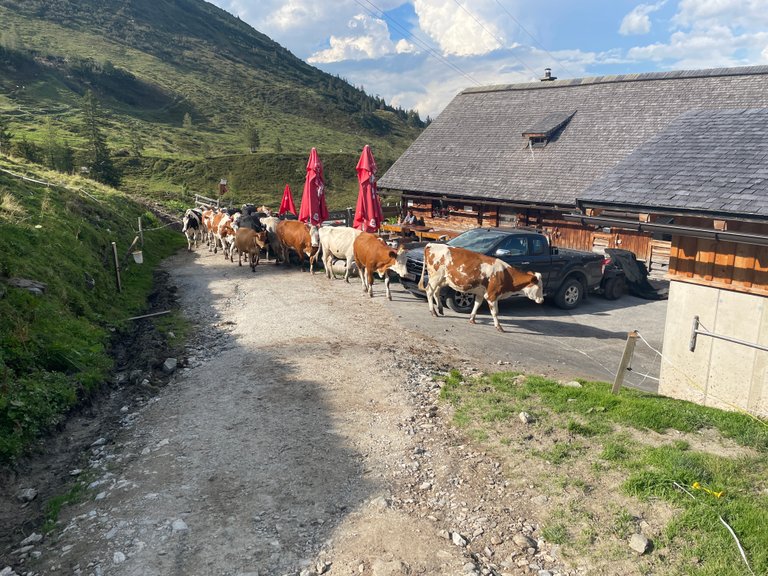
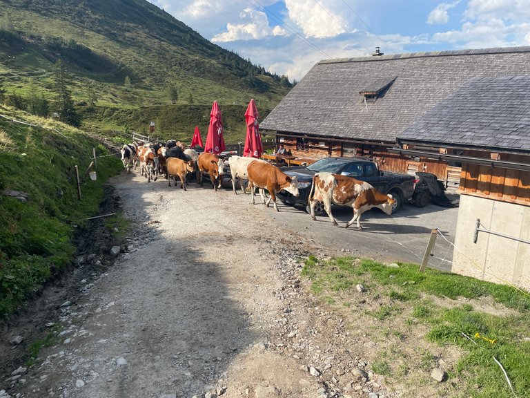
We weren’t the only ones heading down before dark. Cows can block a mountain path and always have priority. This farm is at about 1,550 meters, so we still had quite a bit of altitude to lose.


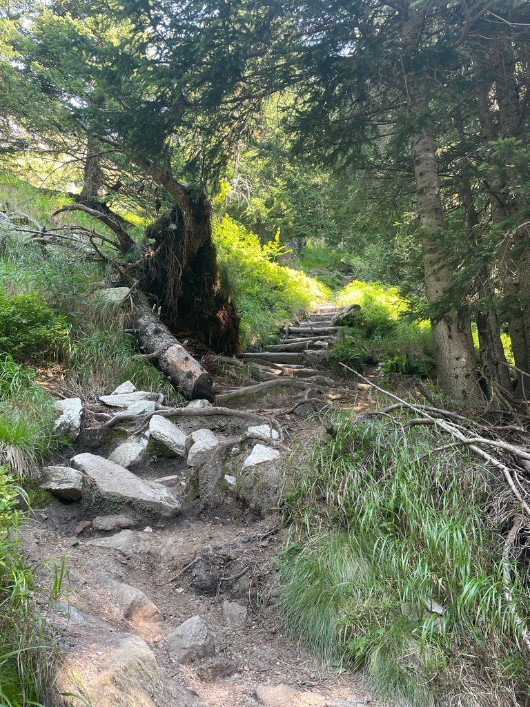
The last part led us through a forested zone again, and we could spot the damage the recent thunderstorm did. No wonder the other path was not accessible.


And then, after a while, we finally reached the village :)


Does a hike count as a Wednesday Walk? I hope so – this is my entry for #wednesdaywalk by @tattoodjay.


Česky z překladače

(ze kterého prý leze slušný text, tak snad vás bude bavit ho číst)

Minulý týden se nám podařilo uniknout z Prahy, kterou zachvátila vlna veder, jakou my Češi považujeme - i když naše vnímání je často poněkud přehnané. Na naši obranu musím říct, že i moji pražští indičtí přátelé z Dillí a Hajdarábádu přiznali, že jim bylo horko, a obviňovali z toho vysokou vlhkost vzduchu. Protože Češi přirozeně milují venkovní aktivity, zejména ve vyšších polohách, nebylo překvapením, že jsme se s mou španělskou přítelkyní rozhodli vyhledat útočiště v Alpách, nejbližším skutečném pohoří od Prahy. Z historických důvodů nazýváme některé kopce nižší než 500 metrů horami. Prvních několik dní jsme strávili v oblasti Gasteinu, kterou jsem několikrát navštívil kvůli lyžování. K dispozici bylo několik turistických tras, dokonce jsme našli jednu, která nabízela osvěžující koupání v horském jezeře ve výšce kolem 1 900 metrů.

Když jsme opustili auto v Schloss Böckstein, staré hornické vesnici na úpatí Zitterauer Tisch (2 463 m), nejvyššího vrcholu, na který jsme ten den plánovali vystoupit, chtěli jsme původně začít túru podél potoka s několika menšími vodopády. Bohužel cesta byla značně poničena nedávnou bouřkou, a tak jsme byli nuceni jít raději po silnici. Nakonec jsme museli jet autobusem tunelem, do kterého je zakázán vstup chodcům a cyklistům. Tato objížďka nám ušetřila trochu času, protože jsme autobusem ujeli dva nebo tři kilometry, a přivedla nás do lyžařského střediska Sportgastein asi 40 minut před plánovaným termínem. Odtud začala túra, když jsme za sebou nechali zpevněné cesty.

Byl jsem rád, že jsme mohli jít několik set metrů lesem, který nabízel stín - přiznávám, že moje španělská přítelkyně je mnohem odolnější vůči horku než já. Lesy v Alpách jsou zdravé a plné divoké zvěře, včetně působivých mravenčích hnízd - tady je jedno.

Jakmile jsme překročili hranici stromů ve výšce kolem 1 800 metrů, mohli jsme alespoň hodovat na borůvkách rostoucích podél cesty. Byly právě zralé a docela osvěžující. A pak... jsme zahlédli draka, který hlídal jezero. Proslulý Drache vom Bockhartsee.

Na rozdíl od většiny svých příbuzných tento drak nemluví - nebo nás alespoň nepovažoval za hodné konverzace. Možná ho zastrašil pastýřský hrdina, který se k němu blíží od jezera. Doufali jsme, že budeme svědky epické bitvy, ale zdálo se, že nepřátelé spokojeně čekají, až ten druhý udělá první krok. Jaké geniální strategie museli vymýšlet! Sestoupili jsme tedy k Bockhartsee, které je ve skutečnosti spíše nádrží než přírodním jezerem. Přesto stojí za to se v jeho křišťálově čisté vodě vykoupat.

Bockhartsee je osvěžující a chladné, jak se v horách dá očekávat. Navzdory chladu jsem se cítil osvěžující a jsem si jistý, že jsem ještě nikdy neplaval v tak vysoké nadmořské výšce. Pokud se někdy ocitnete v této části Alp, doporučuji vzít si s sebou ručník.

Nemohli jsme se zdržovat příliš dlouho, protože celá túra měla trvat asi 8 hodin a na nejvyšší vrchol nám zbývalo vystoupat ještě asi 700 metrů. A tak jsme pokračovali dál mezi borůvkami a úchvatnými výhledy.Už jsem se zmínil, že lesy překypovaly životem, a na pláních nad hranicí stromů tomu nebylo jinak.Potkali jsme tři hady - příliš záludné na to, aby je zachytil můj telefon - a mnoho ještěrů, motýlů a dalších.A pak tu byla tato žába, která nám ochotně zapózovala na fotku.Vzhledem k tomu, že poblíž je drak, mohla to být zakletá princezna - kdo ví...

Asi ve výšce 2 200 metrů se cesta stala kamenitou a nakonec se změnila v cestu přes balvany.Dalo by se očekávat, že to bude doména divokých horských koz, ale výrazný zápach trusu naznačoval, že na alpských pastvinách hodují jiná zvířata.Ano, krávy.

Nejdůležitější rozhodnutí dne nás však teprve čekalo. Měli bychom se vydat po Panoramatické stezce, která překvapivě nevede přes vrcholy, nebo se vydat náročnější cestou, která vede přímo přes ně? Samozřejmě jsme si vybrali tu druhou možnost.

Z obrázků to možná není patrné, ale bylo dost větrno.Přesto si na cestě připadáme jako v pohádce.Vybrali jsme si opravdu dobře.

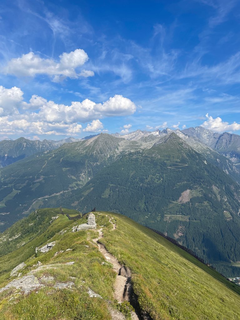
Vesnice, kterou můžete vidět na některých fotografiích, je zámek Böckstein, kde naše túra začínala.Není to daleko - jen asi 2,5 kilometru.Je však asi 1300 metrů pod námi, a právě z toho se skládala závěrečná část naší túry - ze zdánlivě nekonečného sestupu.Tento kříž zdobí vrchol Tischkogelu (2 409 m).Až sem byla cesta v pořádku.Pak ale začal strmý sestup. Přesvědčte se sami na následujících snímcích.

Nebyli jsme jediní, kdo se před setměním vydal dolů.Krávy mohou zablokovat horskou stezku a mají vždy přednost.
Tato farma se nachází ve výšce asi 1 550 metrů, takže jsme měli před sebou ještě docela dost výškových ztrát.

Poslední úsek nás opět vedl zalesněným pásmem a mohli jsme si všimnout škod, které napáchala nedávná bouřka. Není divu, že druhá cesta nebyla přístupná.

A pak jsme po chvíli konečně dorazili do vesnice :)

Translated with DeepL.com

Posted Using InLeo Alpha

Sort:  

Wow! This is epic!

What a nice trip.

The Alps are great for both hiking and skiing ;) Give them a shot if you can :)

Went to the French Alps once for cycling and to see the Tour de France. It was awesome! This brought back memories.

Then it is a good post ;)

Exactly.

Wow, really beautiful trek and very well presented too. Love the photos! 💚

I'm glad you liked it. Thanks for stopping by!

It's so beautiful and I consider the Landscape another of Nature's bounties.

The place looks beautiful and peaceful, it must be very comfortable to be there.

If you find hiking all day comfortable, then yes, it is :))

I don't go anywhere without my towel...

The views are breathtaking and the lake feels cold through the screen.

There are no dangerous animals there such as lynxes, wolves or... I don't know, the kind you don't want to have a ‘close’ encounter with?

There's a frood who really knows where her towel is!*

It was not that cold at all - around 22-24 °C but sunny all time, you it felt hotter. There are some predators that have been reintroduced within last few decades, but they are rather timid. However, we spotted several eagels and hawks. There's generaly no need to worry about animals though, unless you behave like an arse yourself :)

*The Hitchhiker's Guide to the Galaxy reference

El lago caliente jaja... 😄 I already knew about the towel. I wrote about it here one day a long, long time ago. A challenge in which I wrote for 30 days about everyday objects. That was when I arrived at Hive.
I love being a galactic hitchhiker LOL.

Nope, the lake was really fresquito - it's watered by mountain springs and glaciers. Definitely not like the Caribbean Sea ;)

It was not that cold at all - around 22-24 °C but sunny all time, you it felt hotter.

👆 🙄 😁

Pero te peinas o te haces los papelillos? o la coldwave? 🤣

  • tengo que ir a probar eso. Es la conclusión de todo este asunto del lago del dragón.

Pues, el aire estaba a 22 °C y el agua a 14 °C creo :) Pero me recuerdo haber que esquié cerca de aquí a 10 grados bajo cero 😜 Eso se llama coldwave ;)

😅😜

Dang, you could have split this up into at least four separate posts with all those great photos! This reminds me of my recent trip to the Rocky Mountains. I wish we could have done some more hiking while we were there, but time just didn't allow it.

Splitting one trip to multiple posts does not sound right :) You can enjoy it from the very beginning to the end with me ;) It's true that I did not take many photos at the very end, I was getting a tad tired too ;)

Nah, I do it all the time. It's all about the commentary you add to it! I think your pictures were wonderful. I loved this post! In fact, I'm going to change my vote on it right now it was so good!

Oh, I am so flattered :) Thanks, I always strive to do my best around here ;)

Incredible landscapes and colors

Oh wow! This looks incredible! That water seems like the perfect escape from the heat. I'm not a fan of hot weather, and the lack of shade might be tough, but it's so beautiful that I'd definitely put up with it just to hike there.

The lake is watered by glaciers and mountain springs, so the water was like 57F :) definitely not hot ;))

I really wanna go here, but this looks far away from our home

World has become way smaller with planes ;)

Without a doubt, there’s nothing better to escape the heat than visiting nature. Beautiful photographs! I would love to visit this place; it looks stunning

Never been in the alps, but after reading through your post and seeing your photos, I'm sure I want to go. Must be pretty nice to take a freezing bath in the lake after a long walk.

It was not freezing, just quite cold :) do stop by once you have a chance - there are multiple international airports with rather good connections to all around the globe there ;)

😳🤯

Congratulations, your post has been added to the TravelFeed Map! 🎉🥳🌴

Did you know you have your own profile map?
And every post has their own map too!

Want to have your post on the map too?

  • Go to TravelFeed Map
  • Click the create pin button
  • Drag the marker to where your post should be. Zoom in if needed or use the search bar (top right).
  • Copy and paste the generated code in your post (any Hive frontend)
  • Or login with Hive Keychain or Hivesigner and click "create post" to post to Hive directly from TravelFeed
  • Congrats, your post is now on the map!
PS: You can import your previous Pinmapple posts to the TravelFeed map.
map
Opt Out

Congratulations, your post has been added to WorldMapPin! 🎉

Did you know you have your own profile map?
And every post has their own map too!

Want to have your post on the map too?

  • Go to WorldMapPin
  • Click the get code button
  • Click on the map where your post should be (zoom in if needed)
  • Copy and paste the generated code in your post (Hive only)
  • Congrats, your post is now on the map!

Very good and beautiful photography, I am very interested

This was quite a journey...

What do you mean cows always have priority in the descent?😂

The panaroma trail looks relatively unsafe though 😂😂
A slight wobble and you're rolling down over 1000 feet😂😂
Plus you said it was windy...

Once the herd moves, you cannot pass :))

Yep, the path on the peaks was quite tricky. We wouldn't go this way if the stones were wet and slipery for sure.

Congratulations @godfish! Your post made the TravelFeed team happy so we have sent you our big smile. Keep up the good job. 😃

Thanks for using TravelFeed!
@for91days (TravelFeed team)

PS: Did you know that we have our own Hive frontend at TravelFeed.com? For your next travel post, log in to TravelFeed with Hive Keychain or Hivesigner and take advantage of our exclusive features for travel bloggers.

When I was a kid my dream was always do a hiking in the Alpes lol . Well maybe I still make it but at least I saw that there are mountains closer that I can go easier! This way I visited the Andes which have pretty views ! You would love to go to El Chaten and hike to see the Fitz Roy!

That’s for sure ;) I am definitely into the Andes too. I might go to Colombia once, I have a couple of friends from there. And then I wouldn’t miss the mountains, if it’s at least a bit safe to explore them :)

Přiznávám, že text jsem nečetl (ten vyplivnutý z translátoru by mi stejně ani nešmakoval), ale vizuálně jsem si pochutnal :) To jsou panorámata! Kopců jsem už všude možně prolezl celkem dost, ale v Alpách, které jsou tady za humny, jsem paradoxně v podstatě ještě nebyl :) To by se mělo jednou napravit...

@tipu curate 4

Díky za tipáka. Zrovna tahle trasa moc kids friendly není, ale najdou se i lehčí, které chodí lidé s malými dětmi :) a lyžovat se dá tak od tří čtyř let, ale vím, že vás na zimní sporty moc neužije.

Mohl sis přečíst ten anglický originál ;) opakovaně jsem tu zaregistroval názor, že překladače produkují super texty, na které si nikdo nestěžuje. Myslím, že je to prostě proto, že dotyční cílovému jazyku nerozumí. Ale třeba se ukáže, že jim tenhle překlad opravdu přijde dobře napsaný i v rodné řeči :)

Došlo mi, že to byl záměr, aby se někteří "dvojjazyční" autoři tak trochu chytli za nos ;) V češtině i angličtině translátorem vyplivnutý text většinou poznám po prvních pár slovech (a odcházím :D)

Případný čtenář zvenčí pochopitelně většinou také :) Což z pochopitelných důvodů reflektují i vyhledávače, které se uživatelům snaží najít relevantní obsah a ne web, ze kterého po pár slovech odejdou. Ale o tom už jsem tu psal :)

This post has been manually curated by @bhattg from Indiaunited community. Join us on our Discord Server.

Do you know that you can earn a passive income by delegating to @indiaunited. We share more than 100 % of the curation rewards with the delegators in the form of IUC tokens. HP delegators and IUC token holders also get upto 20% additional vote weight.

Here are some handy links for delegations: 100HP, 250HP, 500HP, 1000HP.

image.png

100% of the rewards from this comment goes to the curator for their manual curation efforts. Please encourage the curator @bhattg by upvoting this comment and support the community by voting the posts made by @indiaunited.

Thanks, @bhattg ;)

Hiya, @ybanezkim26 here, just swinging by to let you know that this post made it into our Top 3 in Travel Digest #2294.

Your post has been manually curated by the @worldmappin team. If you like what we're doing, please drop by to check out all the rest of today's great posts and consider supporting other authors like yourself and us so we can keep the project going!

Become part of our travel community:

It looks like a great hike, and the photos are nice! I am sure you were tired at the end. But where's the beer? 😎

I only blog about microbreweries as I love sharing beer stories. We did stop by one later on during our stay, but it was closed due to a bank holiday :/

Yes, it's OK. I always have a beer at the top if we go hiking in the mountains. I usually have it with me, but in all mountain huts in Slovenia, if they are open, they have beer to offer.

Same here, even though we don't have like real mountains - there's just a single peak having 1,500+ meters, and we even share it with Poland :)

Yes, I understand. But I'm not a real hiker. I'm hiking only to my nearest mountain - 1792 m Snežnik. I have one old post here if you're interested... maybe I should go up again :) https://ecency.com/mountain/@seckorama/going-up

Well, I have Slovenia on my to visit list, perhaps for some rafting or similar activities :)) You really saved words in this post :))

Well, that's true. But that was seven years ago, and Steemit... maybe this extreme winter on Snežnik https://ecency.com/hiking/@poss/5-hiking-day-extreme-cold-weather-on-mount-sneznik-1796m-a-day-to-remember

:)

This is amazing!!!!
Great works of nature. From the pictures aloe, I felt like I had left my home and I'm there taking a walk too. Really great photos, the mountains, rocks, valleys and water bodies look stunning.
Thanks for sharing.

Hello godfish!

It's nice to let you know that your article will take 8th place.
Your post is among 15 Best articles voted 7 days ago by the @hive-lu | King Lucoin Curator by hallmann

You receive 🎖 0.6 unique LUBEST tokens as a reward. You can support Lu world and your curator, then he and you will receive 10x more of the winning token. There is a buyout offer waiting for him on the stock exchange. All you need to do is reblog Daily Report 398 with your winnings.

2.png


Invest in the Lu token (Lucoin) and get paid. With 50 Lu in your wallet, you also become the curator of the @hive-lu which follows your upvote.
Buy Lu on the Hive-Engine exchange | World of Lu created by szejq

If you no longer want to receive notifications, reply to this comment with the word STOP or to resume write a word START