In 2011 I made a month-long trip to Ghana before I even moved there to do some research on when starting my Ecotourism business. I tried to visit as many eco-lodges and natural sites as I could. This post details one of the days on that trip where my father and I walked probably close to 20km along the coastline through villages and beaches, and over capes. When I was a student in Ghana in 2004 I visited one of the first Ecolodges in this area and fell in love with the place. This journey starts there. This post is not a new update on my life as it was still in the post window as one I had started months ago. So let me get this out of the way and then we move to some newer content again.
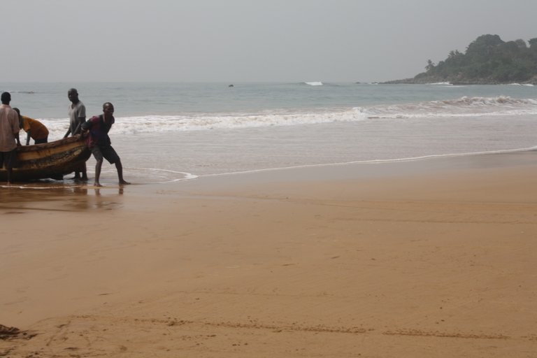
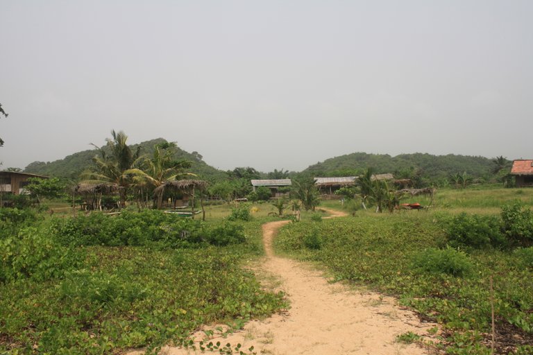
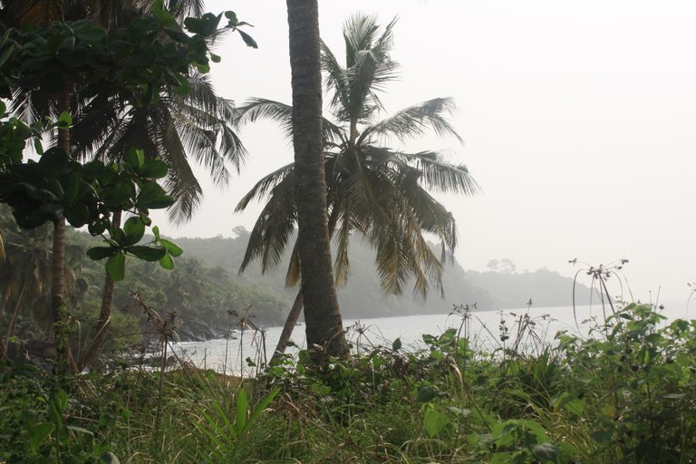
We started our morning at Green Turtle Ecolodge near Akwidaa, Ghana. This is about 7 hours to the west of the capital Accra. We had a nice breakfast of fried bananas, honey, and French toast. The journey started with a walk down the beach to the village of Akwidaa. As we were going some fishing boats were taking off from the beach to go fishing. Sadly the sky is a very bleak gray in most of these pictures because of the hammatan. This is a season where sand from the Sahara desert blows down and creates a fog-like effect in the air.
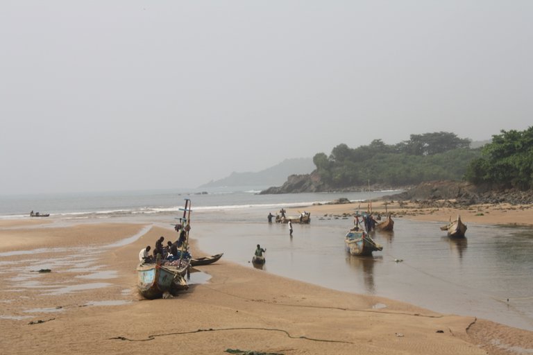
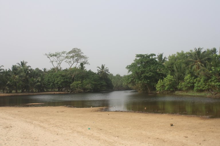
Akwidaa is a small fishing village split in two by a river and a lagoon. The old Akwidaa is where we started which has a very rough road that is not so much anymore. Old Akwidaa is more traditional and not growing as much. There is a point there that has the ruins of an old Portuguese fort and is a sacred grove to the community overgrown by the jungle now. The picture above shows where the river meets the sea in Ezile Bay. It was low tide but some of the fishing boats are still navigating the opening to the lagoon.
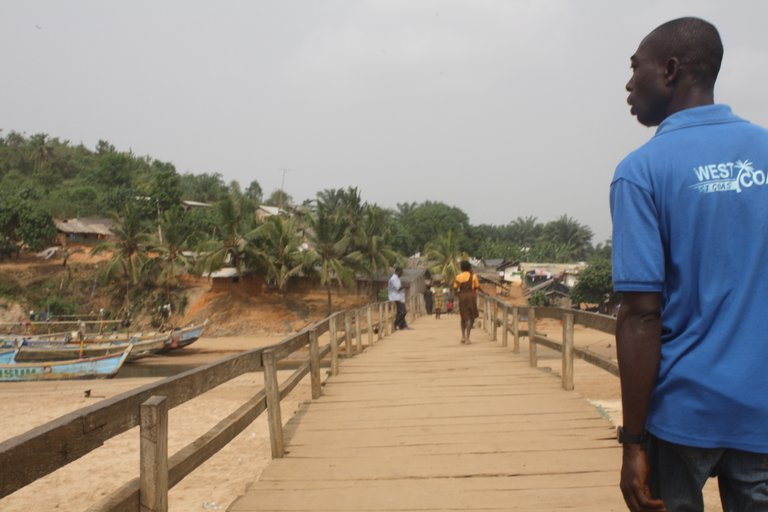
New Akwidaa is reached by this wooden footbridge. New Akwidaa is a growing town and it has a better road connecting it to the rest of the world. This is where the school is and many of the newer houses. On my first visit here there was no bridge so the kids either swam or had to get a lift in a canoe to school each day if they lived in old Akwidaa. You can see one student in uniform crossing the bridge here.
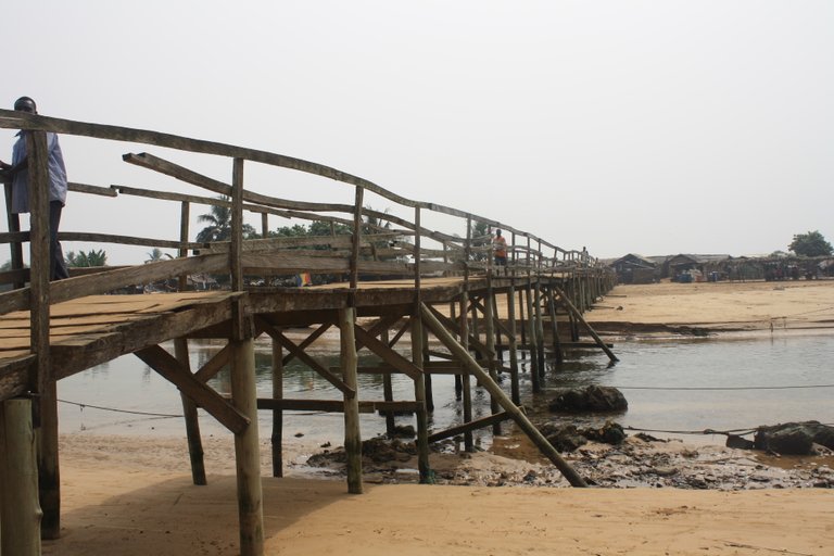
Here is another view of the bridge and the river. These bridges are quite interactive to walk on as they sway and creek and move as you pass over them.
This trip took us on a walk from Akwidaa to Princess Town along the way there are jungles, ecolodges, a lighthouse, villages, and lagoons to visit. This was our first stop was Ezile By Ecovillage. This is still a beautiful place to visit even today as some places like Green Turtle have shut down this place has lasted the test of time. It is a little more run down now but the bay and scenery are just amazing. It has been for sale by its owners for several years without sale yet. I made a post near the beginning of my hive experience about a visit there in May 2021.
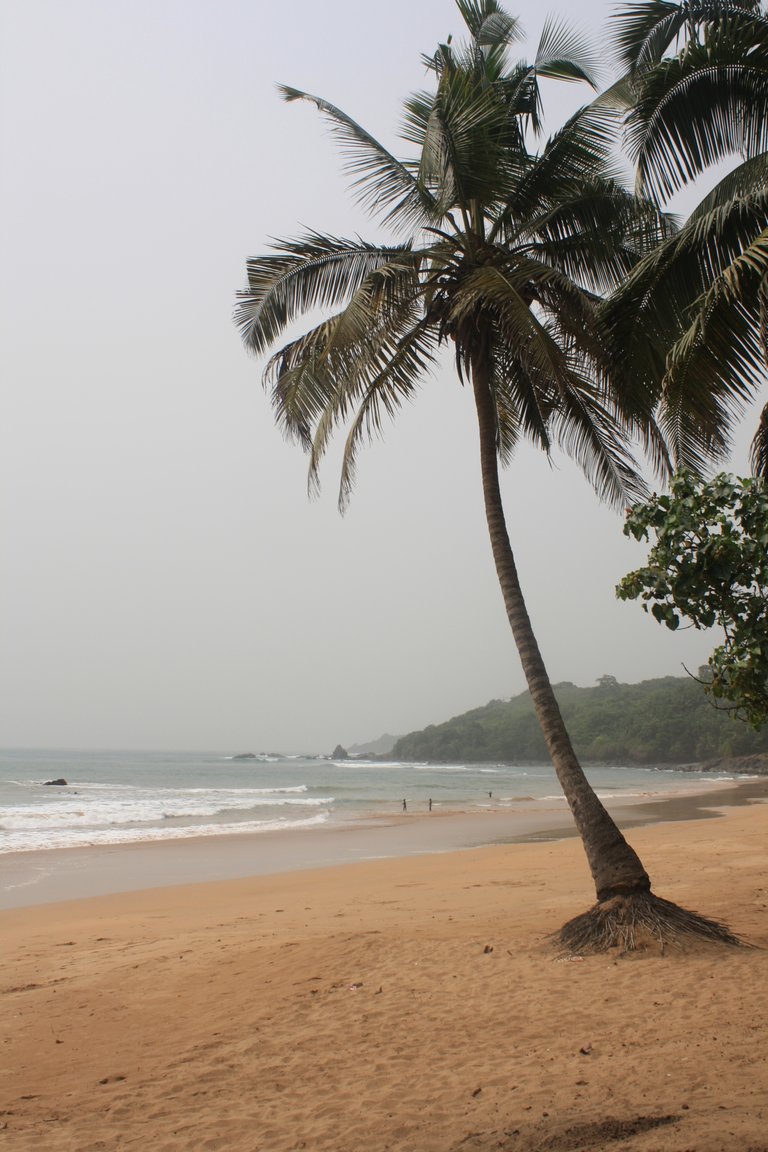
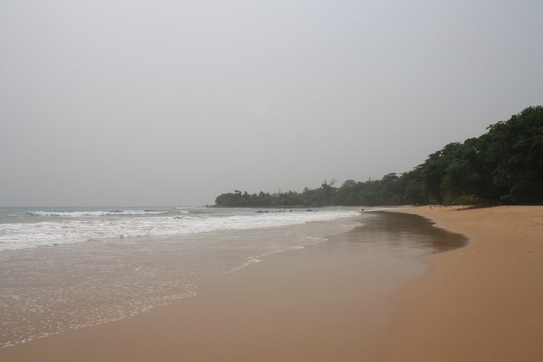
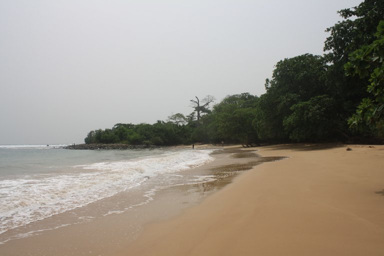
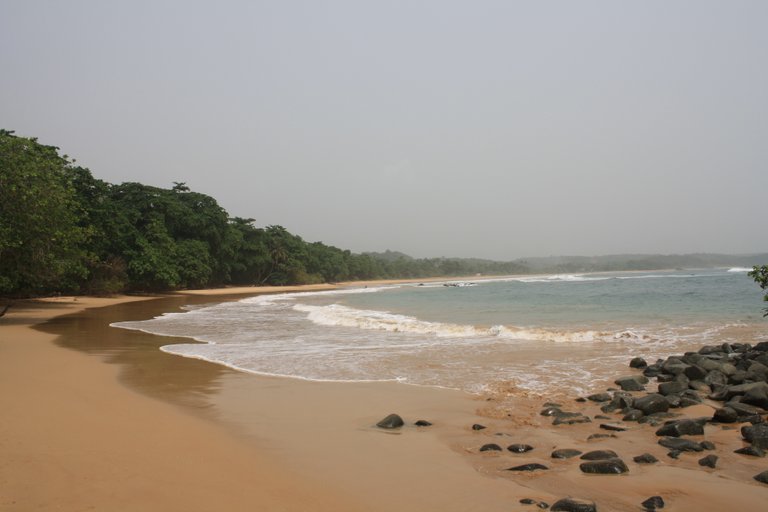
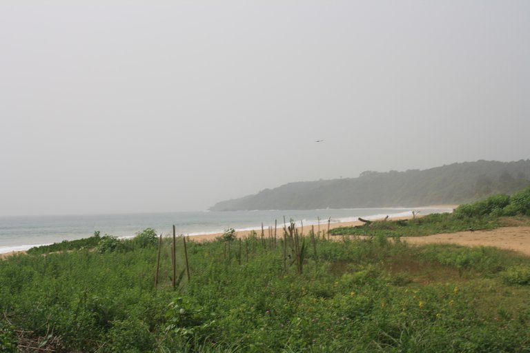
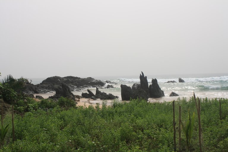
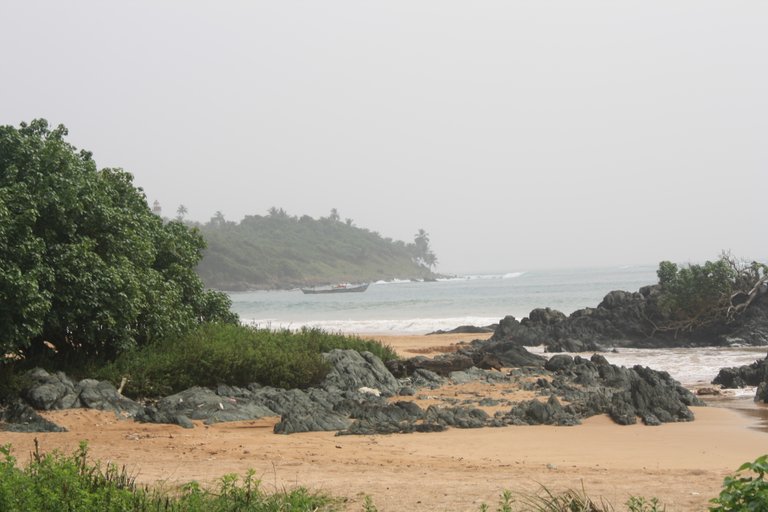
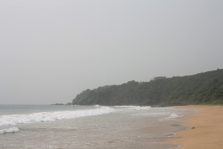
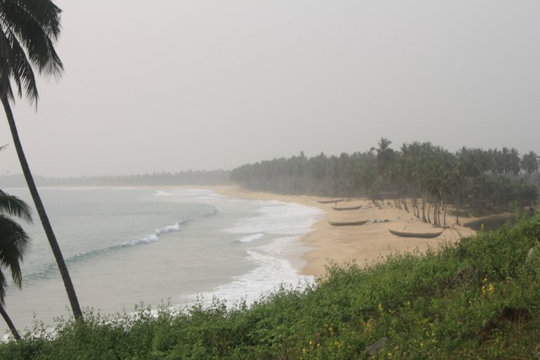
Each beach we came upon was beautiful and empty there would then be a little cape at each end which we would climb over and find another peaceful cove and empty beach.
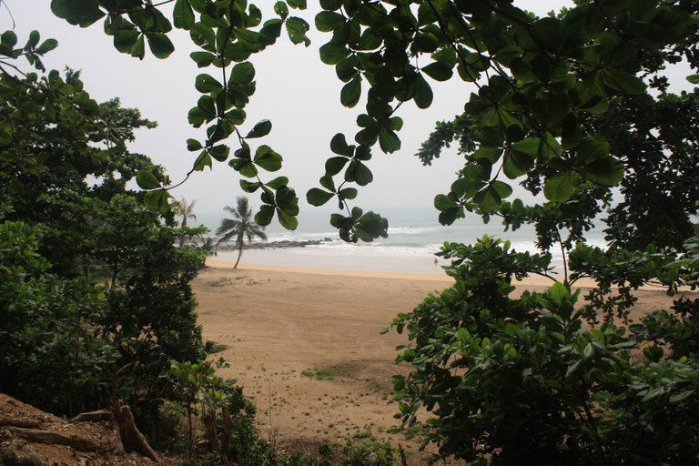
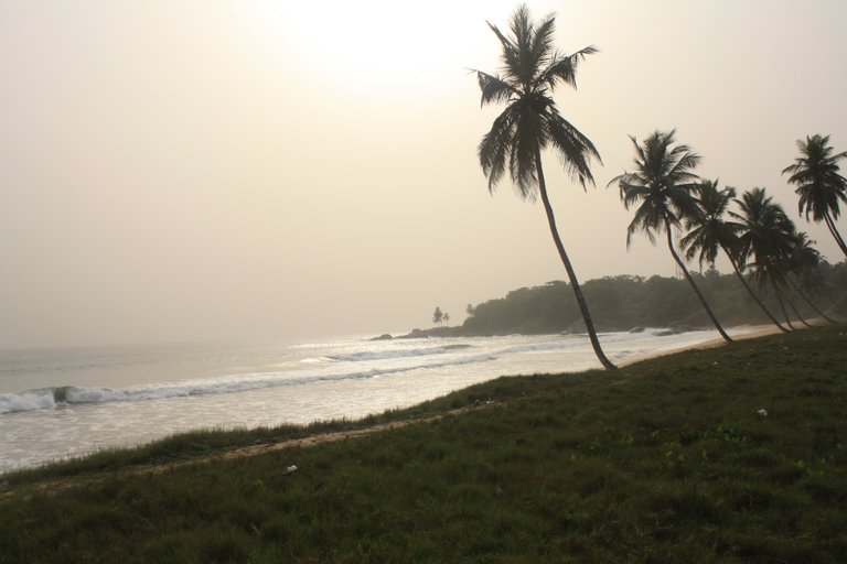
Here is another empty stretch of beach.
This one had a few local children swimming in the water.
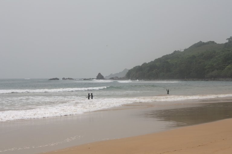
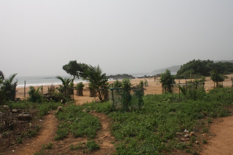
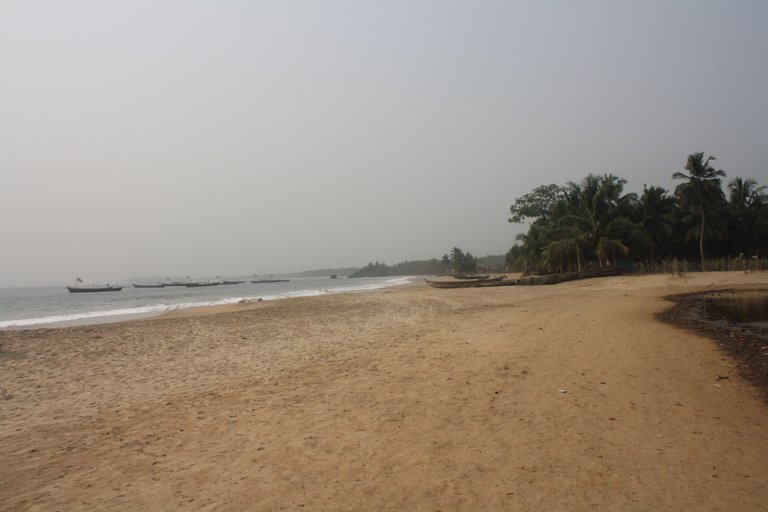
They were blissfully swimming naked and enjoying themselves and their independence in absolute paradise. But this is just another day for them a little fun between work for their parents and finding some food for the day. You can see in the distance a series of capes. The whole complex is called Cape Three Points.
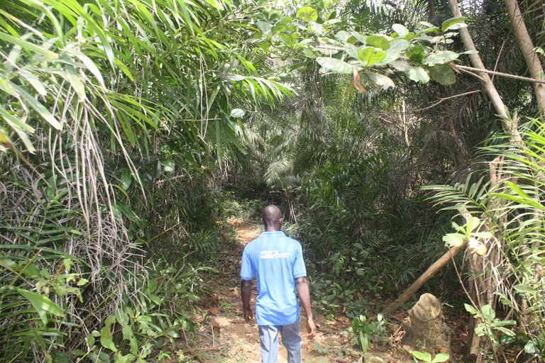
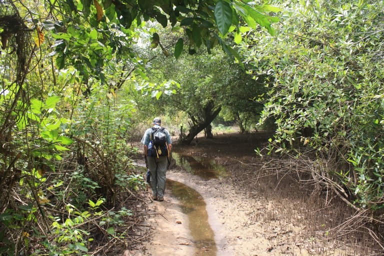
Between the beaches were sections of jungles with the footpath we traveled cutting right through it. There is a reserve in the area with the highest level of biodiversity still found in Ghana. As you walk butterflies circle and dart each and every way.
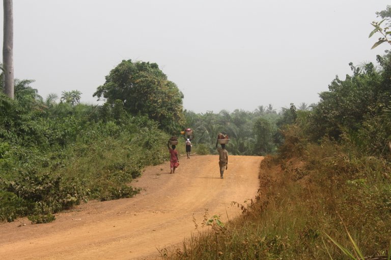
There is supposed to be a network of heritage trails that crisscross the whole area and I was hoping that we would be staying on these single-path trails for the duration of our hike. But it seems our guide was not very familiar with these and the road was the most direct route he knew for some of this journey. You can see here when we joined the road some women were carrying their wares on their heads between the villages.
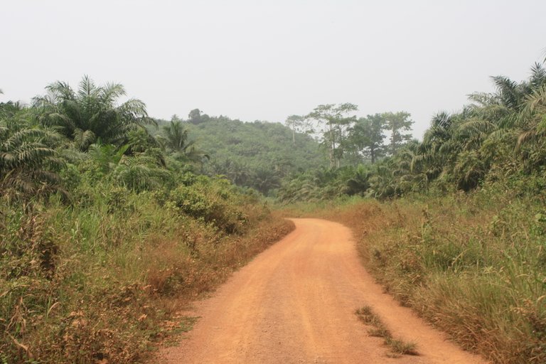
Even though we were on the road it was not busy I don't think we saw a vehicle the whole time we walked it.
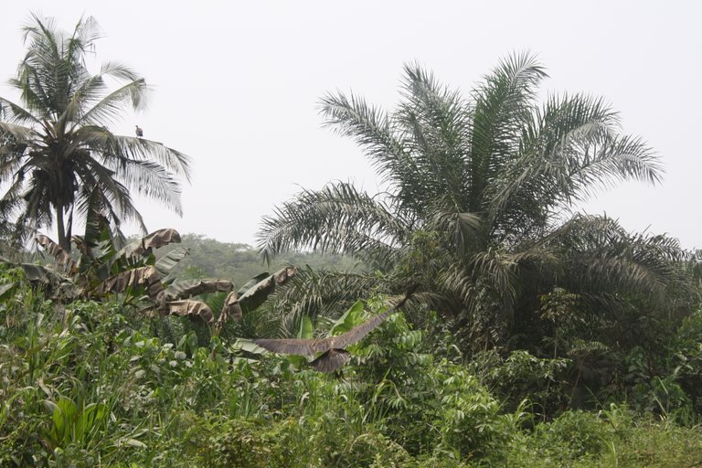
If you look closely you can see a very big vulture here with its wings spread gliding around the tree tops.
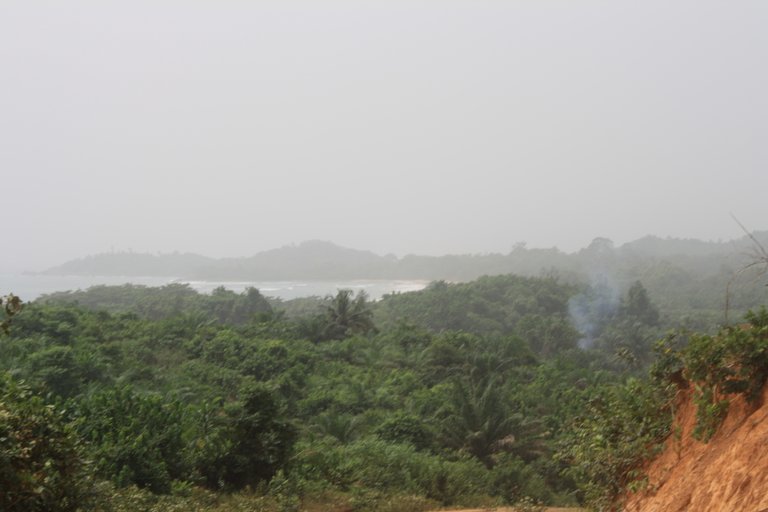
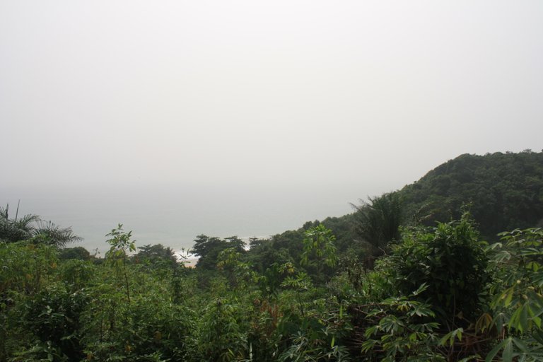
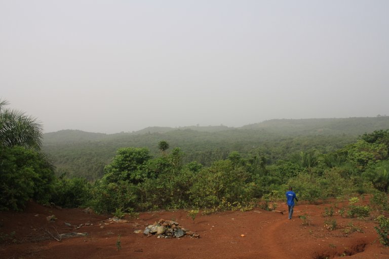
As we made it to the peak of one of the ridges it made for a spectacular view of the jungle below and the main point of the Cape Three Points which we will get to later and visit the lighthouse.
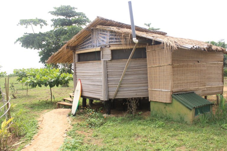
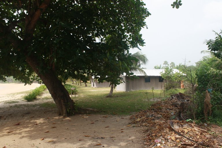
Our next stop for lunch was Escape3Points Eco-lodge which I posted about back in August 2022 when my wife and I visited right before my son was born. This place is completely built by hand by a friend of mine who is an architect and the owner. He is also a fellow permacultist.
It is interesting to look at this picture of how it was then and now. It now has a tall canopy of trees over the top of this whole area.
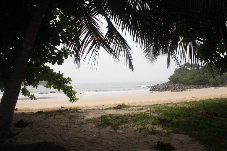
Heading west from the lodge is one of the best beaches I have been to in the world. The sand is stunning clean, and very fine. It shines in the sun maybe from all the gold dust in it. The jungle kind of overhangs the beach at the far end.
Where the rainforest meets the ocean. I love the effect of the overhanging trees and a beautiful empty beach.
At the end of the beach, a rocky point starts where the beach ends. This is a world-class point break from surfing that I would get to surf years later.
From there we trekked into the mangroves, the area is underwater in some parts of the year.
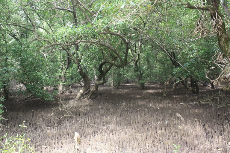
It is like a maze through mangrove roots and trees.
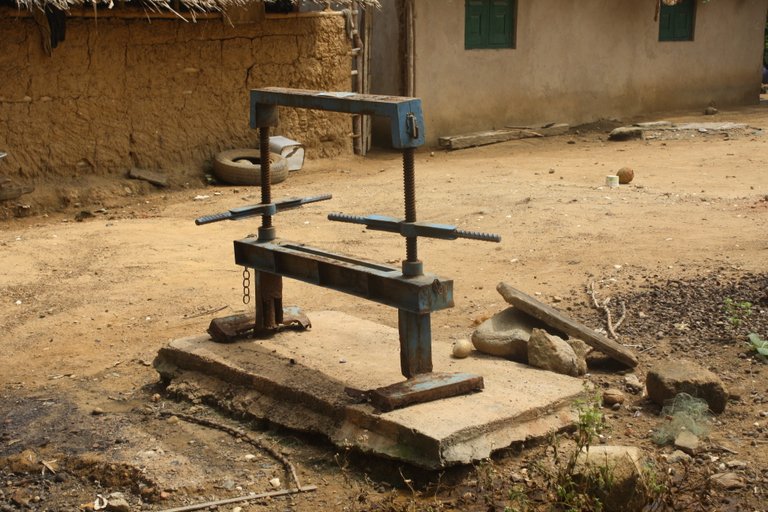
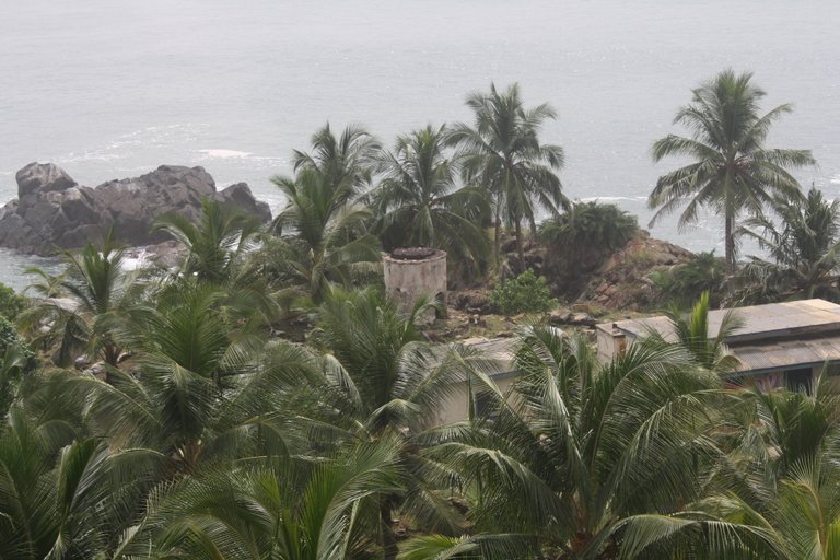
When we came out of the trees at the other end we came to the village of Cape Three Points itself the largest community along our walk. This is a manual press for pressing palm oil and other things.
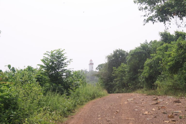
Cape Three Points has a lighthouse out on the point and a small reserve around it that has monkey still. It is a little bit of a detour and walk from the village out to the point.
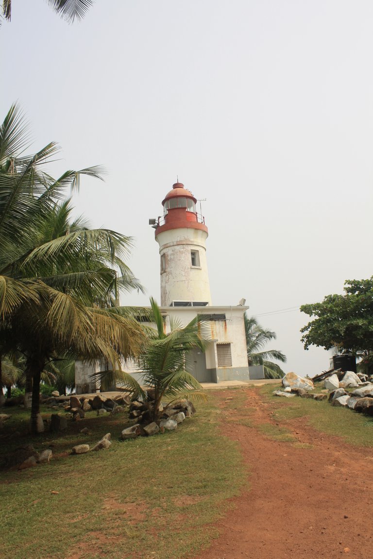
This lighthouse is from the 1920s and is still operational some of the time. It has been converted to electric light now.
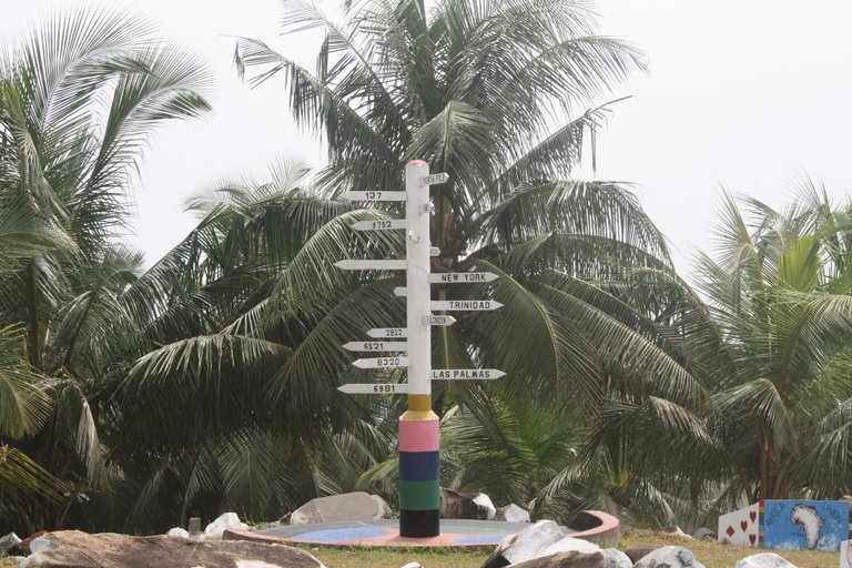
This is the closest land point to the center of the world 0,0 where the prime meridian meets the equator. This sign points to many places around the world.
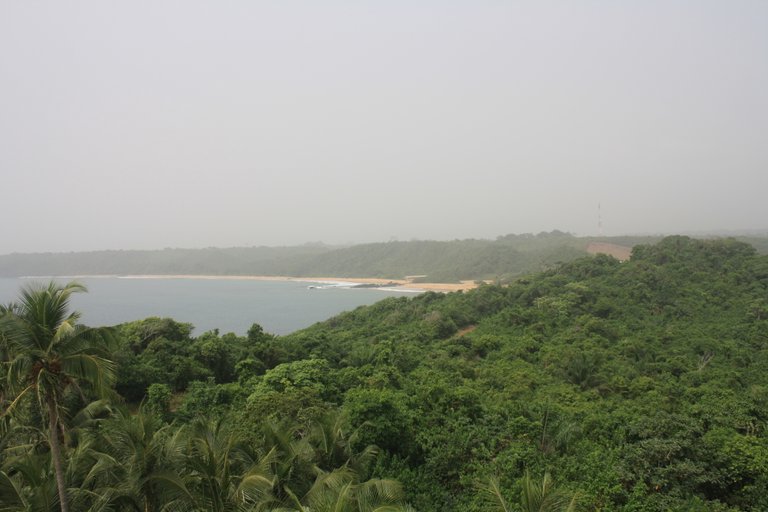
A view to the west where we would continue our trek through more jungles over more capes and across more beaches.
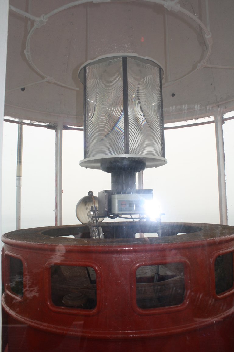
This is the retrofitted electrical light in the lighthouse.
A view to the point below and an older foundation of another lighthouse from the early 1800s.
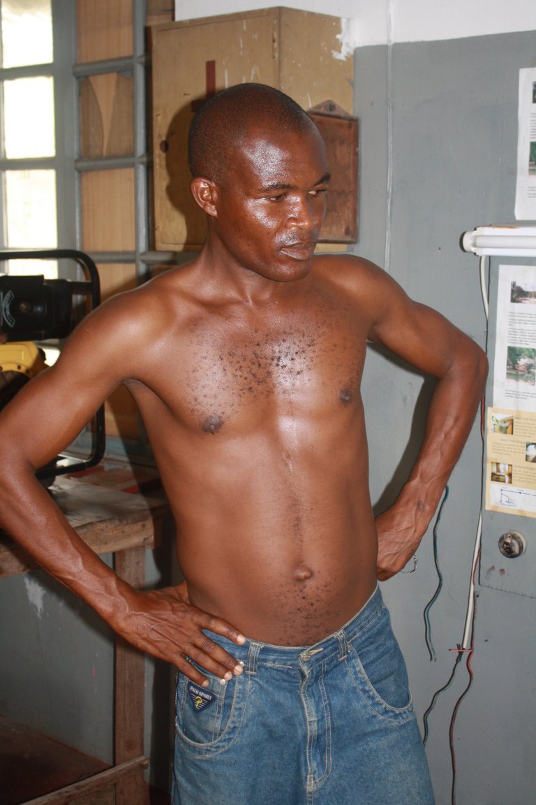
This is the lighthouse keeper his job is to make sure the light comes on each night to keep ships off the rocks below.
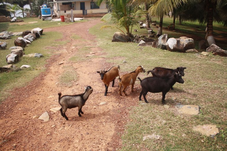
There are several goats in the area that enjoy jumping from rock to rock which are everywhere.
As we went back through the village to get on the trail again my dad picked up a whole gang of followers.
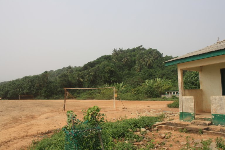
As we left the outskirts of town we went through the school complex this is the largest community in the area so it is a catchment for students from all the smaller communities around.
A view of the next cape to cross.
I believe that these capes were caused by ancient volcanic flows that made for some interesting geology along the way and some sharp rock outcroppings. The tops of the capes where they have been worn down by wind and water are a course volcanic gravel in contrast to the rich deep soil along the sides of the hills and the valleys, then of course the sandy beaches too.
Looking back at the main cape you can just barely make out the lighthouse to the left of the picture before the tree covers it.
The last view of the lighthouse and the cape.
Looking at the road ahead it was going to be a long trudging along the soft beach with no shade and then up steep hillsides in the rainforest with no breeze. You can imagine the sweat that flowed that day.
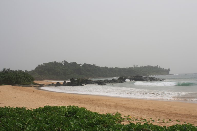
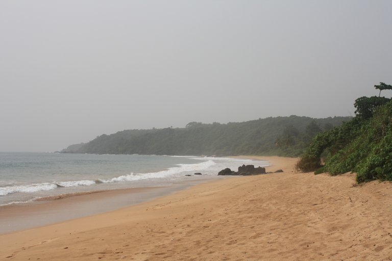
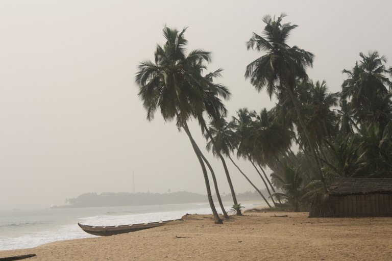
View after view of empty clean beaches.
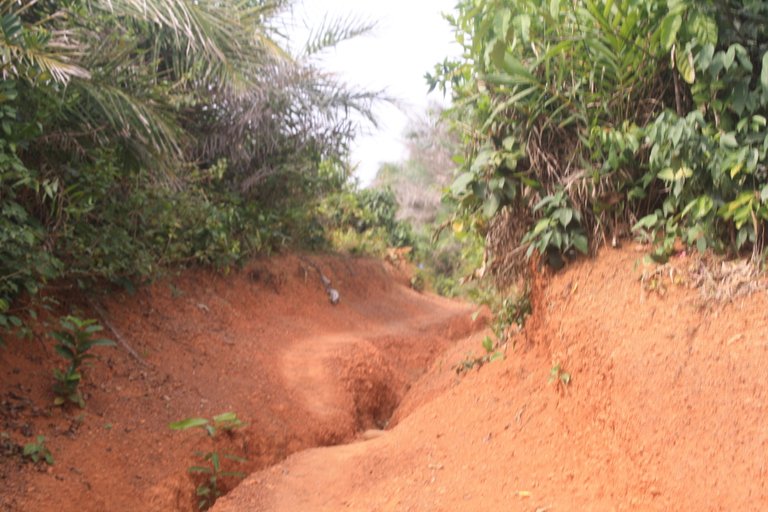
The trails were sometimes very steep and eroded.
Reaching the top of each climb we were rewarded with another view and some more breeze.
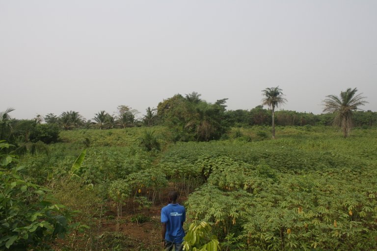
The area was a mix of jungles, palm plantations, and other farms. This one was a cassava farm that we made our way through over the top of one of the capes.
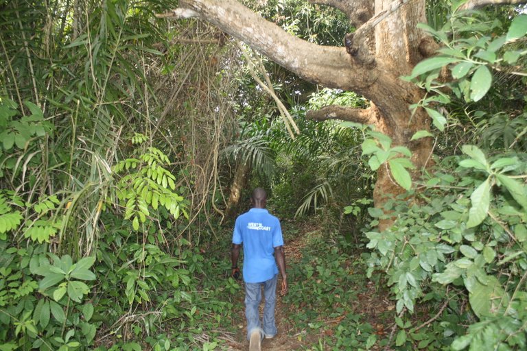
At times the trail was like going through a tunnel of foliage. You can see that even our guide broke a sweat.
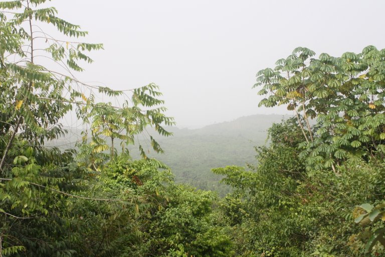
Looking inland there are miles of dense green forest.
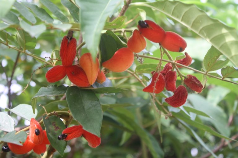
The trees would reward us along the way with exotic colors, fruits, and blossoms. This may be a cashew tree.
Looking into the distance still a lot of trail to go.
After crossing another cape we eventually descended back down to the water line and were rewarded with more views of the ocean and jungle.
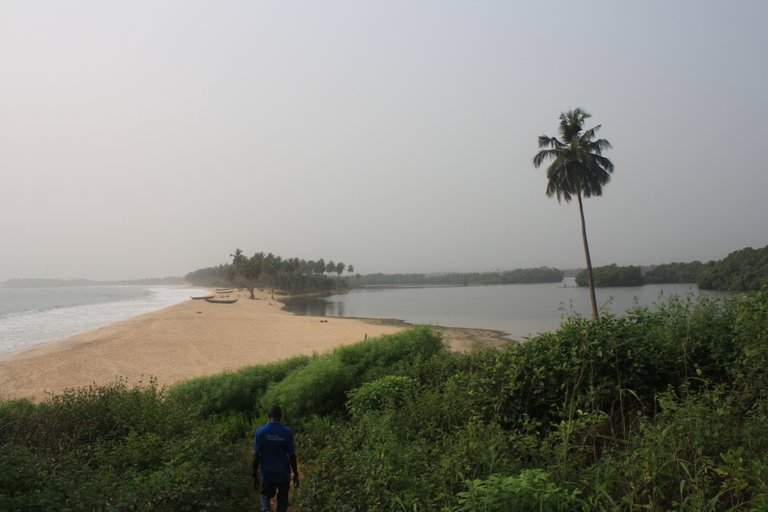
The whole area is dotted with lagoons some little like this one others huge.
This was a huge lagoon with the sea to the left water to the right and just a little strip of sand and palm trees in-between.
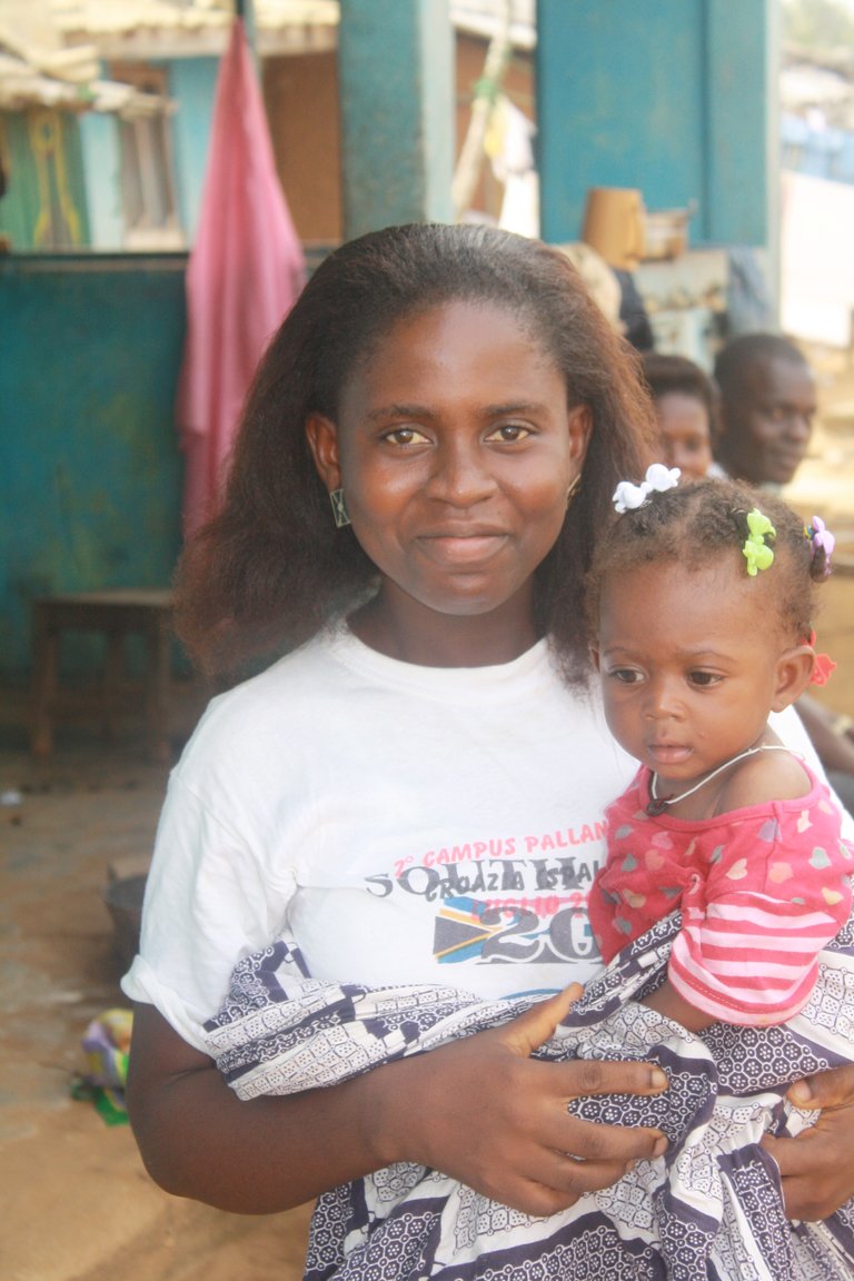
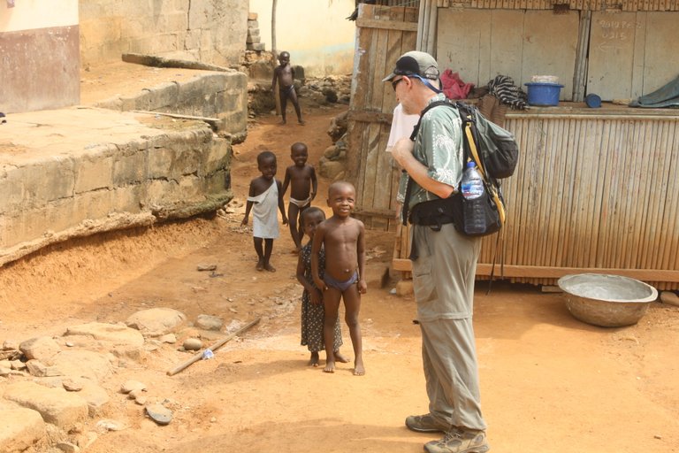
When we met communities we were greeted by friendly people and curious children.
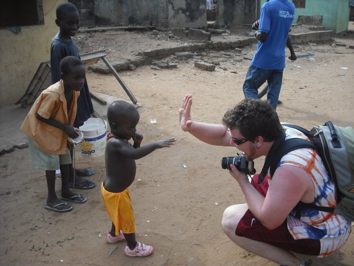
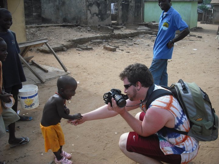
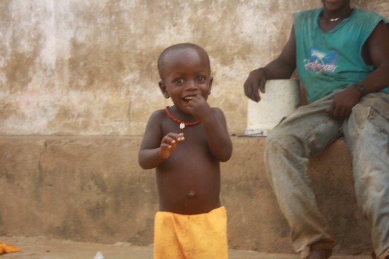
This little guy was so happy and excited to see us walk into his village he was amazed to see his picture.
The last stretch of our trek took us along a large lagoon and fishing village.
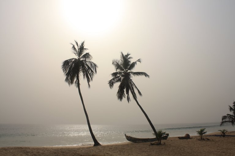
The sun started to get lower in the sky for the end of our walk making for an interesting effect with the hammattan air.
The point in the background is Princess Town the end of the trail for us.
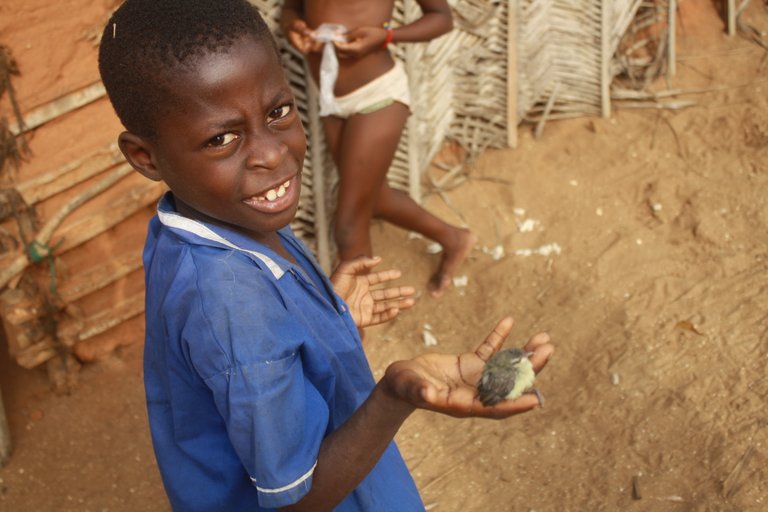
This guy proudly showed off his pet bird as we passed.
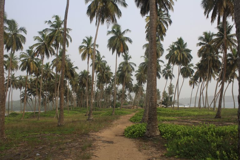
The last bit of trail after the village took us through a coconut plantation.
Sunset was well on its way and just in time as we finished our hike. That was not the end of the day for us. We met with our driver in Princess Town but we spent about another 2 hours driving until we got to our hotel for the night. Needless to say, I think I had a very sound night's sleep after that.
Thank you for joining me on another journey.