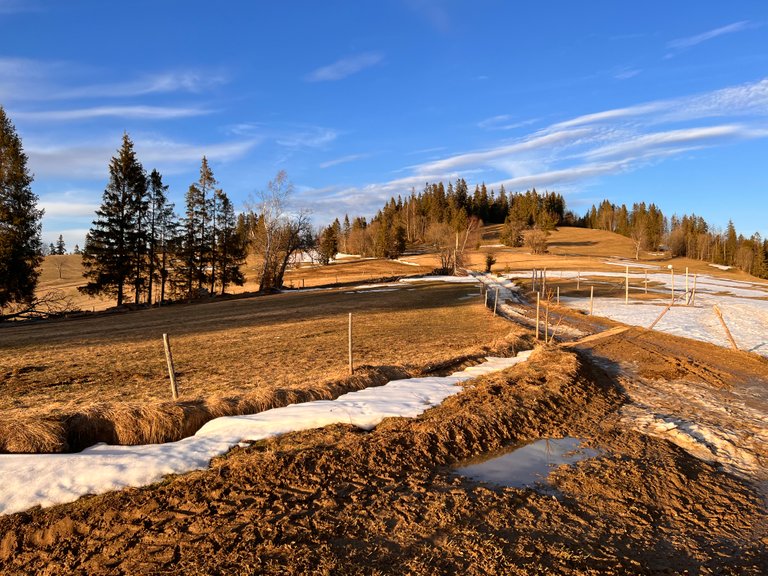
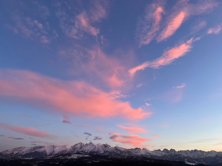
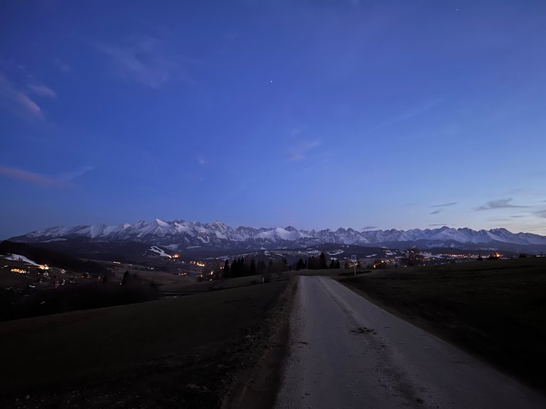
Przełęcz nad Łapszanką.
Jakiś czas temu, przeszukiwałem Internet w celu inspiracji na całodniową wycieczkę w góry. Podczas tych poszukiwań, natknąłem się na informacje podające punkty widokowe w Tatrach, do których można dojechać samochodem. Spodobała mi się taka opcja zapasowa. Uznałem, że będzie to dobra alternatywa dla wycieczek, kiedy nie będziemy mieli całego dnia, a będziemy chcieli wyrwać się gdzieś za miasto, chociaż na kilka godzin i pocieszyć się przyrodą. Sporządziłem listę miejsc i odłożyłem ją na odpowiednie okazje. Okazja na pierwszą taką wycieczkę właśnie się nadarzyła. W weekend dwa tygodnie temu była piękna, wiosenna pogoda. Słońce, temperatura powyżej 15 stopni, praktycznie brak wiatru. Wszystko dookoła nas wołało na łono natury. Był jednak jeden minus. Duża ilość obowiązków przyziemnych bardzo ograniczała czas na wycieczkę. Takim sposobem, uznałem, że to właśnie dzisiaj jest najlepszy moment, aby skorzystać z zapisanej przed dwoma laty, listy miejsc, w które możemy dojechać samochodem.
Mountain Pass over Lapszanka
Some time ago, I was searching the Internet for inspiration for a day trip to the mountains. During this search, I came across information giving viewpoints in the Tatra Mountains that can be reached by car. I liked such a backup option. I figured it would be a good alternative to hiking when we didn't have a full day, but wanted to get away somewhere outside the city at least for a few hours and enjoy nature. I drew up a list of places and set it aside for suitable occasions. The opportunity for the first such trip just presented itself. The weekend two weeks ago was beautiful spring weather. Sunshine, temperature above 15 degrees, practically no wind. Everything around us called out to nature. However, there was one downside. A large number of mundane duties severely limited the time for the trip. Thus, I decided that today was the best time to take advantage of the list of places we had written down two years ago, places we could get to by car.
Wybór padł na Przełęcz nad Łapszanką.
Czytałem już wcześniej o tym miejscu, gdzie można podziwiać przepiękny widok na panoramę Tatr. Oglądałem również piękne zdjęcia wrzucane do Internetu. Postanowiliśmy jechać tam i przekonać się na własne oczy jak jest w rzeczywistości.
Wieś Łapszanka leży między Bukowiną Tatrzańską, Poroninem i Białym Dunajcem. Jest to jedna z najwyżej położonych wsi w Polsce i znajduje się na równoleżnikowym wzgórzu na wysokości 900-1006 m n.p.m.
Współrzędne geograficzne: 49.3440, 20.1978
The choice fell on Mountain Pass over Lapszanka.
I have read before about this place, where you can enjoy a beautiful view of the Tatra Mountains panorama. I also looked at the beautiful photos uploaded to the Internet. We decided to go there and see for ourselves how it is in reality.
The village of Lapszanka lies between Bukowina Tatrzańska, Poronin and Biały Dunajec. It is one of the highest located villages in Poland and is situated on a parallel hill at an altitude of 900-1006 meters above sea level.
Geographical coordinates: 49.3440, 20.1978
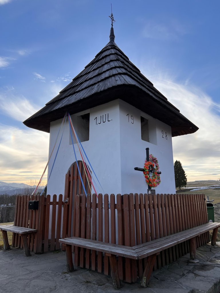
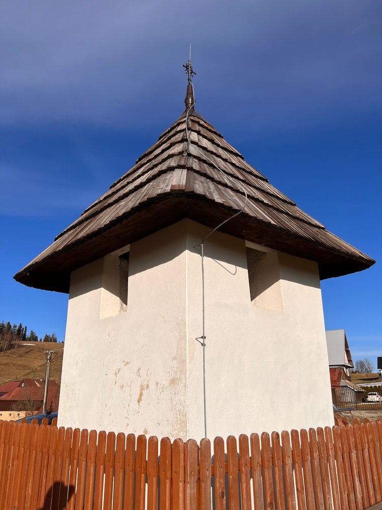
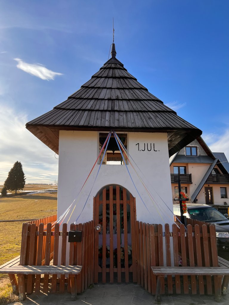
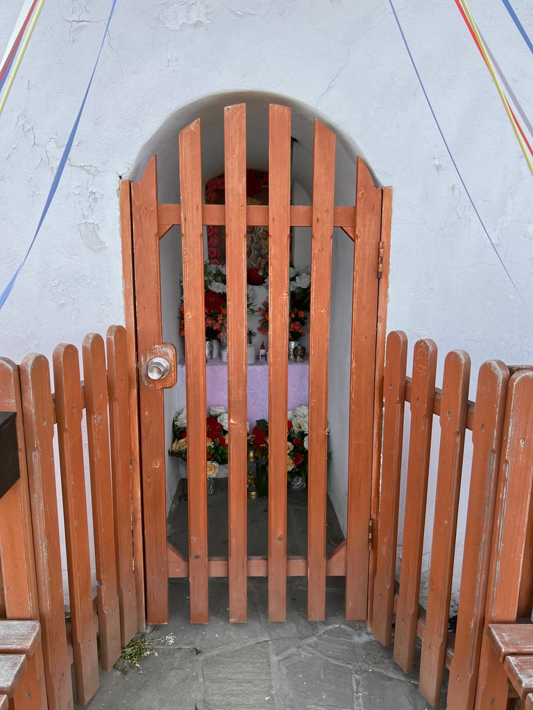
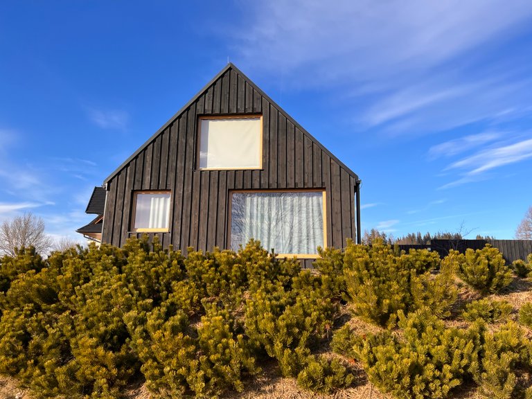
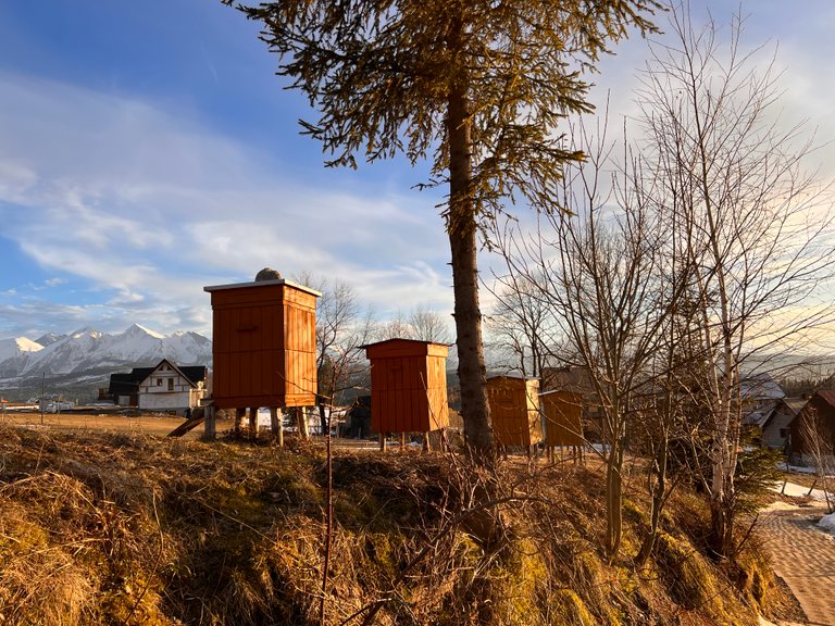
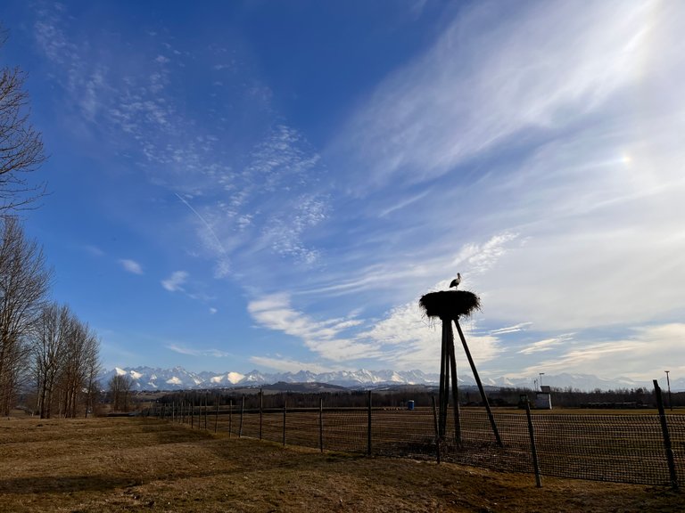
Na przełęczy stoi malownicza, kapliczka loretańska wybudowana w 1928r. Służyła okolicznym mieszkańcom do ostrzegania się przed nadciągającymi burzami. Przy kapliczce jest postawiony krzyż, który upamiętnia śmierć mieszkańca Łapszanki, który 17 lipca 1967 r. zginął w tragicznych okolicznościach, kiedy dzwoniąc na zbliżającą się burzę, został porażony piorunem.
On the pass stands a picturesque, Loretto chapel built in 1928. It served local residents to warn each other of approaching storms. A cross is erected by the chapel, which commemorates the death of a resident of Lapszanka, who died in tragic circumstances on July 17, 1967, when, ringing the bell for an approaching storm, he was struck by lightning.
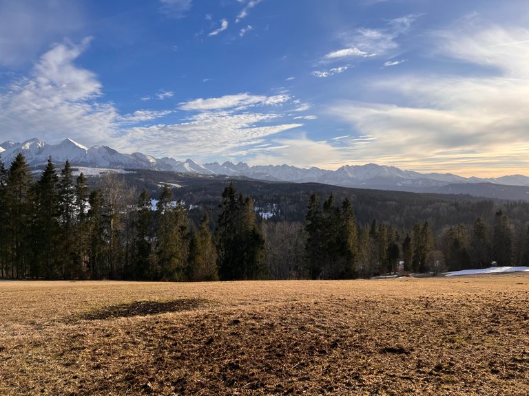
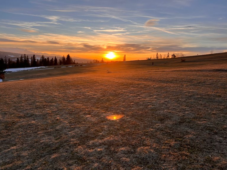
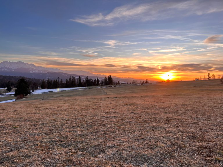
Po dotarciu na miejsce okazało się, że opisy, informacje i zdjęcia nie kłamią. Widok stamtąd jest rzeczywiście przepiękny.
Once we got there, it turned out that the descriptions, information and photos do not lie. The view from there is indeed beautiful.
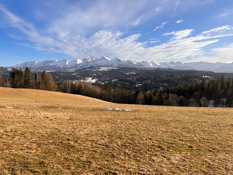
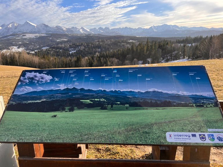
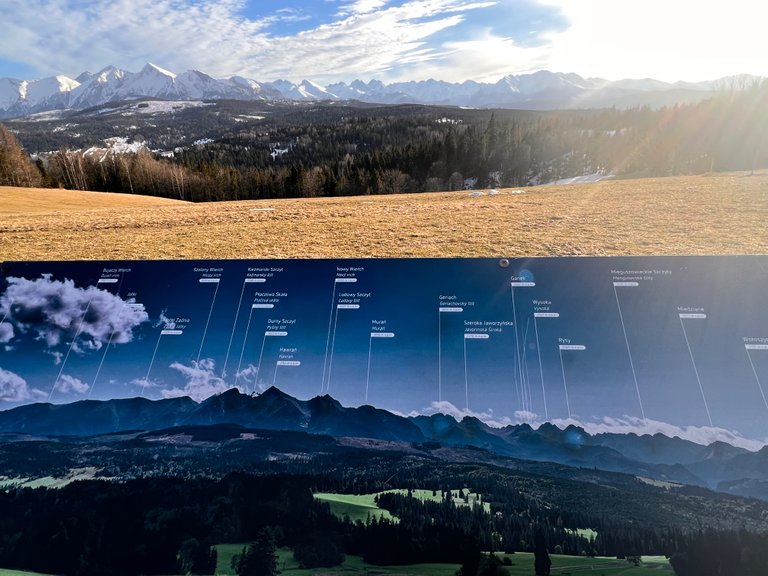
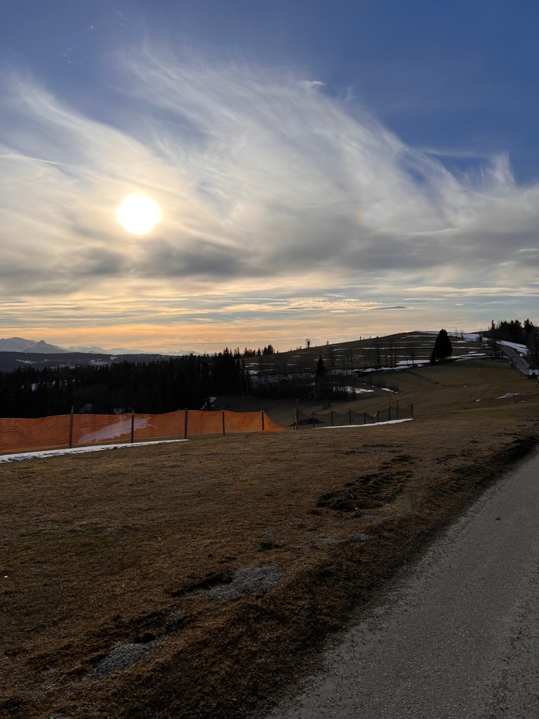
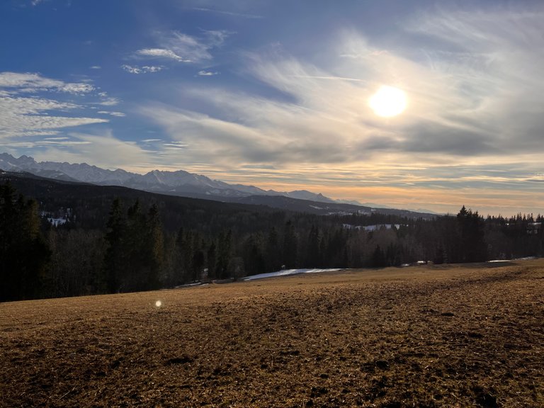
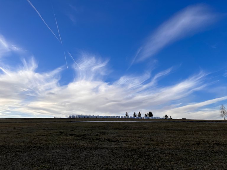
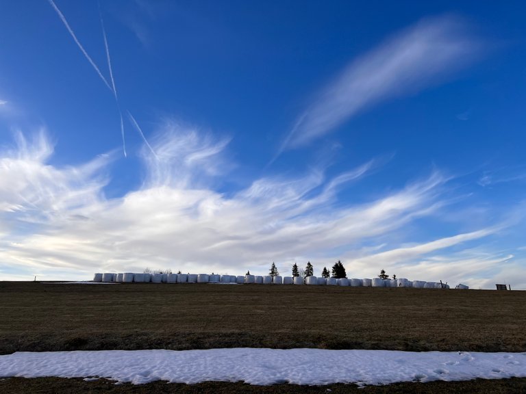
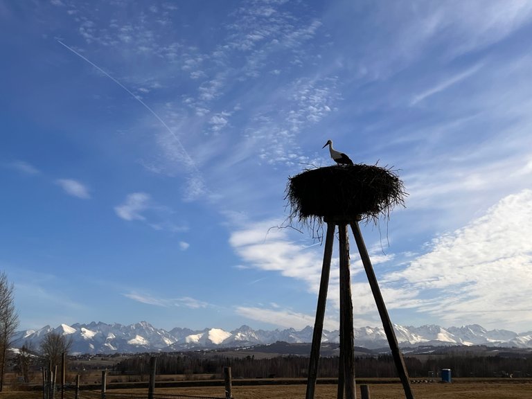
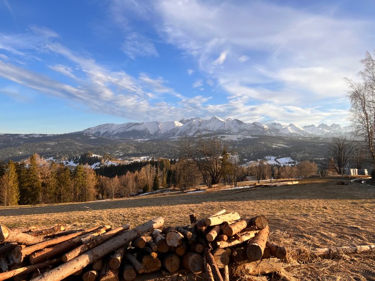
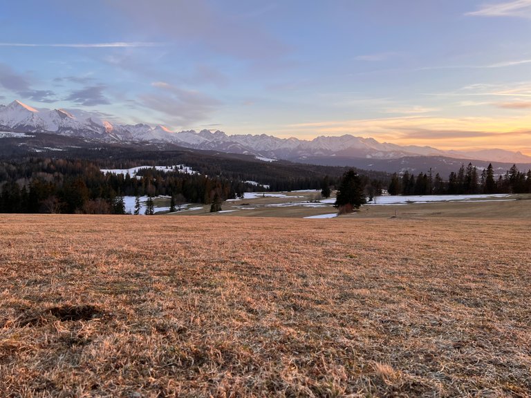
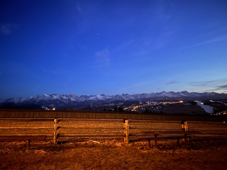
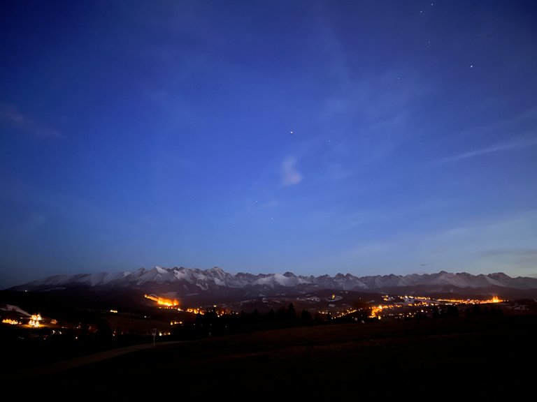
Przełęcz Nad Łapszanką - 940 m n.p.m. - jest malowniczym siodłem w grzbiecie Magury Spiskiej. Z tego punktu widokowego rozpościera się szeroka panorama z niezwykłymi widokami na Tatry Bielskie i Tatry Wysokie – polskie i słowackie. Można stamtąd również dostrzec Giewont (1894 m n.p.m) -najwyższy szczyt Tatr Zachodnich.
Mountain Pass over Lapszanka - 940 m above sea level. - is a picturesque saddle in the ridge of Magura Spiska. From this vantage point you can enjoy a wide panorama with extraordinary views of the Belianske Tatras and the High Tatras - Polish and Slovak. From there you can also spot Giewont (1894 m) - the highest peak in the Western Tatras.
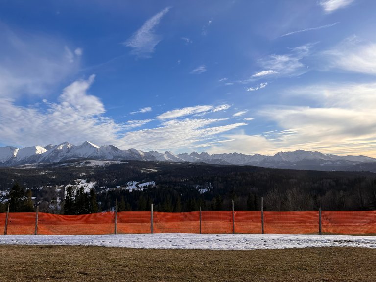
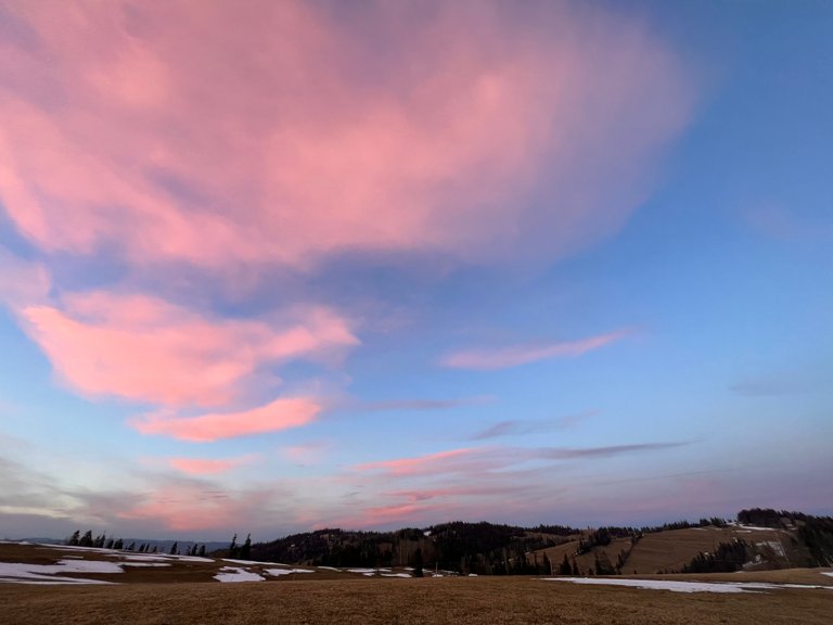
Grzbiet przełęczy jest bezleśny, co ułatwia podziwianie potężnych gór. Rozpościerają się natomiast po nim łąki i pastwiska, które dodają uroku miejscowości i potęgują przyjemne odczucia podczas pobytu.
The ridge of the pass is forestless, making it easy to admire the mighty mountains. Instead, meadows and pastures spread across it, adding to the charm of the village and enhancing the pleasant feeling during your stay.
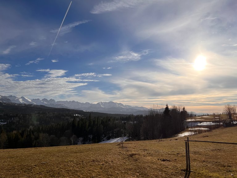
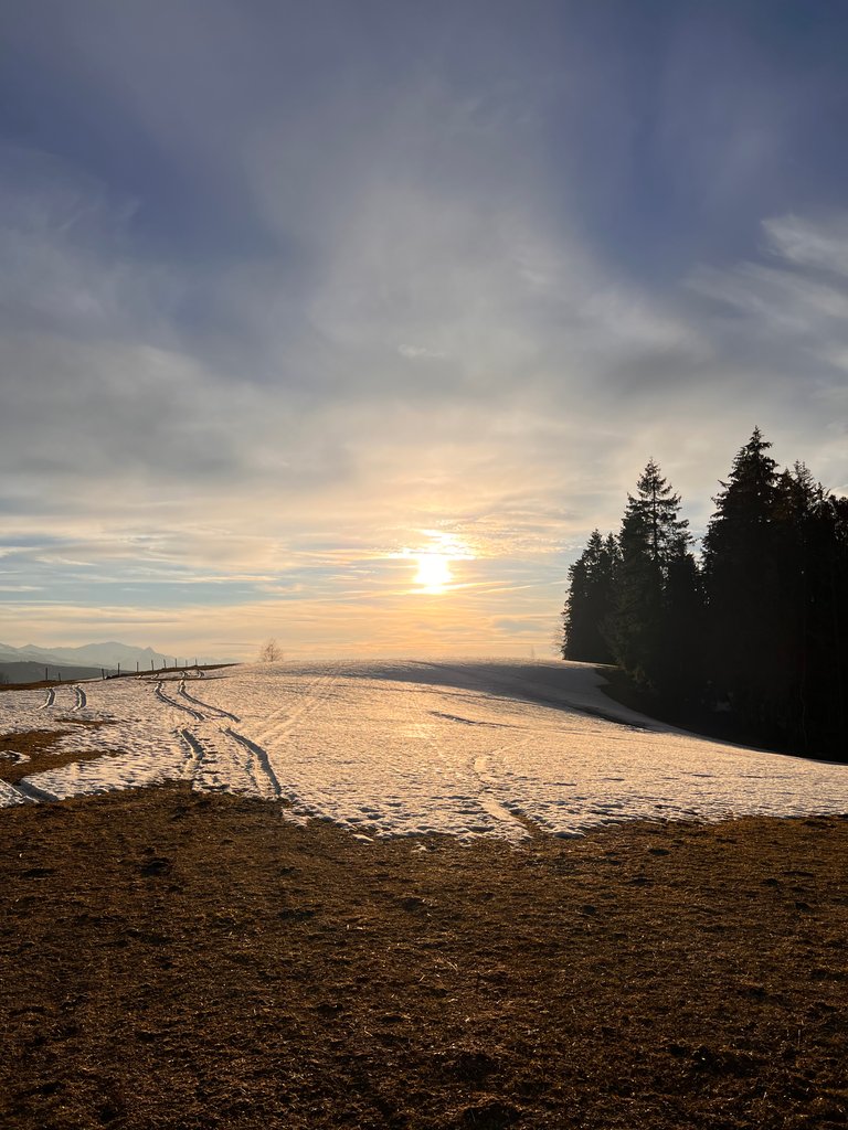
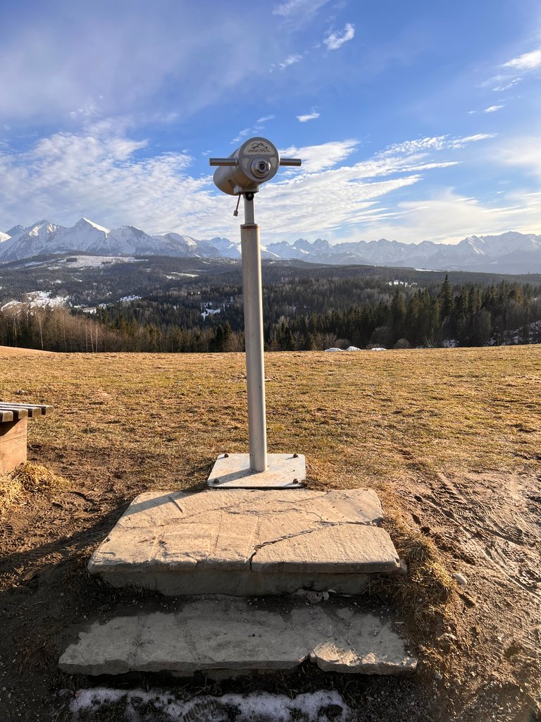
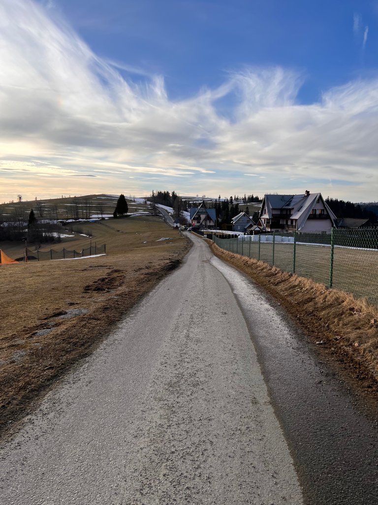
Tak na prawdę, wszystkie te piękne widoki można podziwiać nie wychodząc nawet z samochodu. My przyjechaliśmy na kilka godzin, więc postanowiliśmy pospacerować, w każdym możliwym kierunku i wykorzystać maksymalnie ten piękny dzień. Schodziliśmy teren wzdłuż i wszerz.
In fact, all these beautiful sights can be enjoyed without even leaving the car. We came for a few hours, so we decided to walk around, in every possible direction, and make the most of this beautiful day. We walked the area length and breadth.
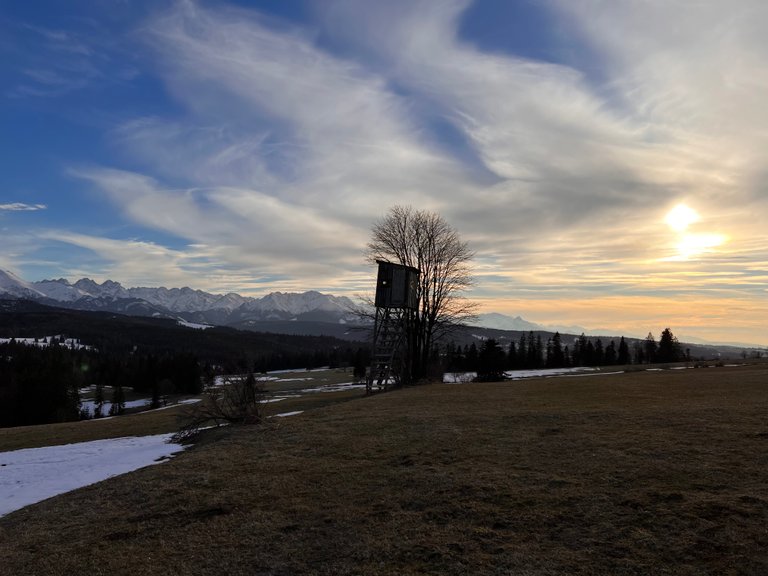
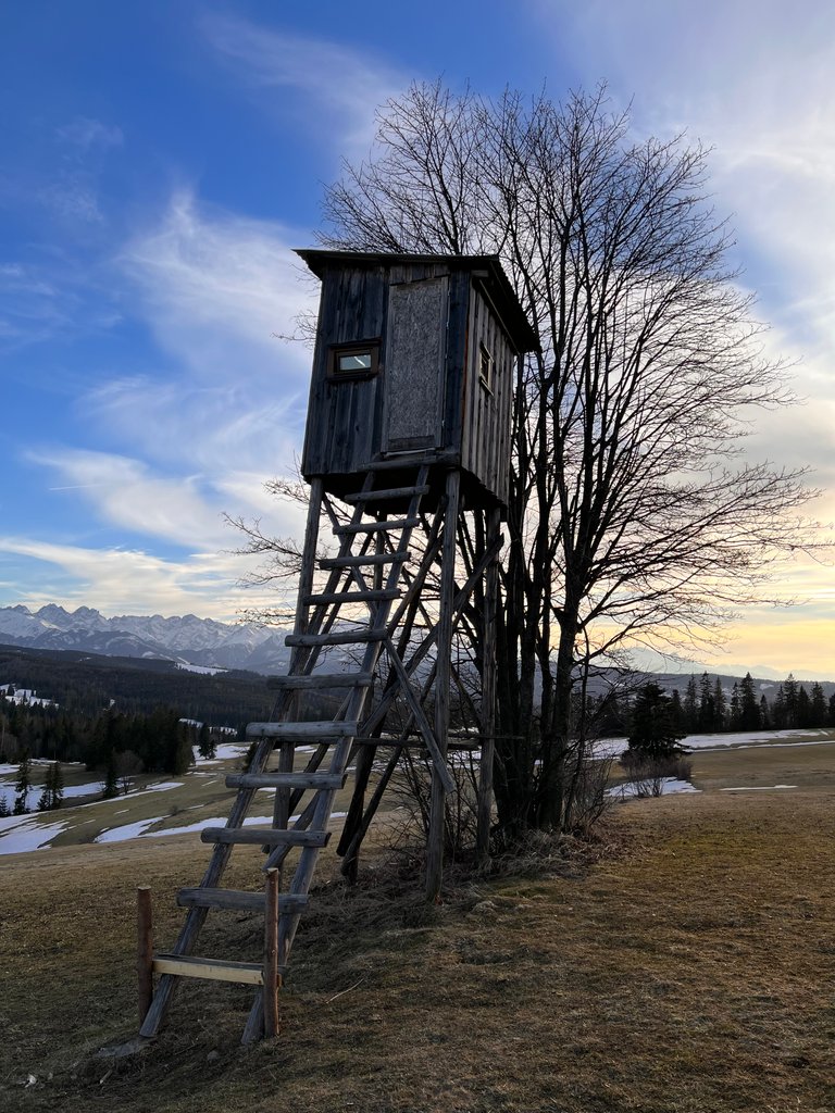
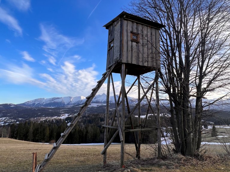
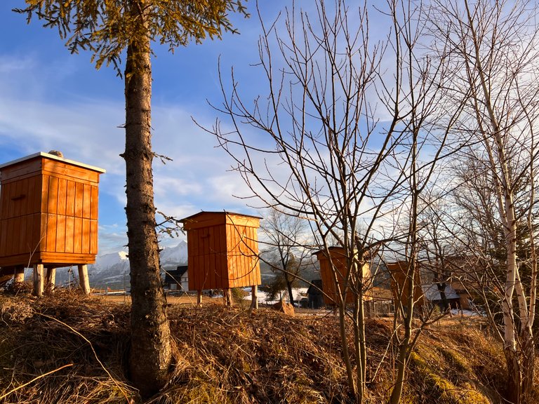
Nieopodal kapliczki znajduje się ambona myśliwska.
Near the shrine is a hunting pulpit.
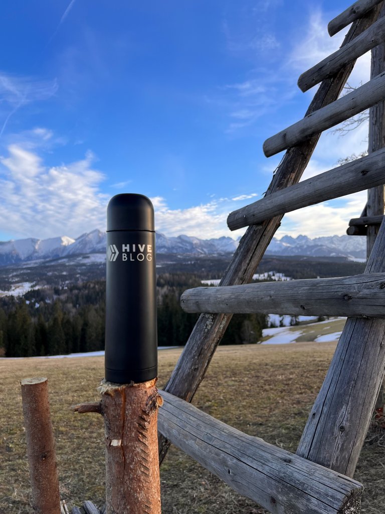
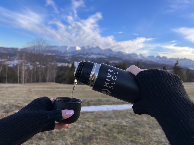
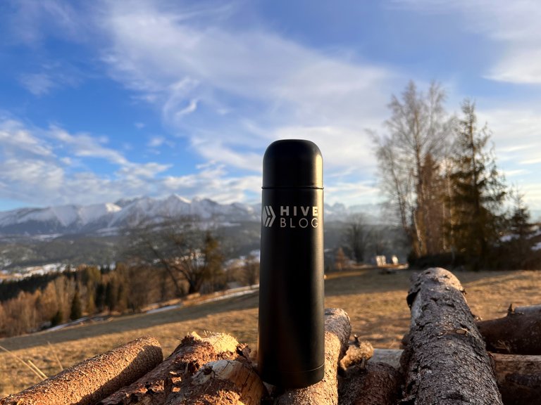
Korzystając z okazji, w końcu mogę pochwalić się swoim termosem, który mam na wyprawy takie jak ta. Póki co nie miałem, kiedy tego zrobić, a termos już się trochę zniszczył, bo towarzyszy mi głównie na co dzień w pracy.
I take this Opportunity to finally show you my thermos, which i take for trips like this one. I haven’t had this Opportunity earlier and the thermos has already worn out a bit because it accompanies me on a daily basis at work.
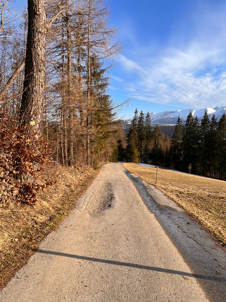
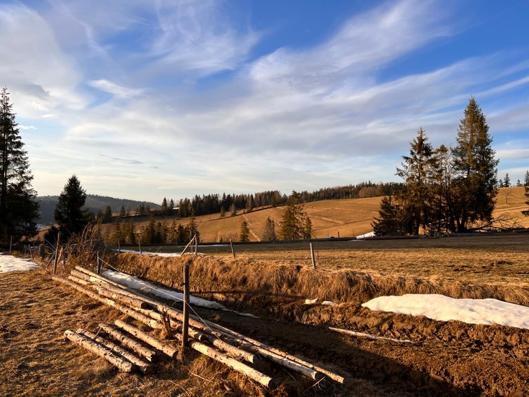
Prócz spacerów po tej urokliwej miejscowości, udaliśmy się żółtym szlakiem, w kierunku szczytu Kopylec (1035 m n.p.m.). Kopylec zalicza się do jednego z wyższych szczytów Spiszu. Położony jest bezpośrednio na północny-wschód od Przełęczy Nad Łapszanką. Do lat osiemdziesiątych na jego szczycie stała wieża strażnicza Wojsk Ochrony Pogranicza. Nie dotarliśmy na szczyt, zawróciliśmy mniej więcej w połowie, aby nie przegapić zachodu słońca.
In addition to strolling around this charming village, we took the yellow trail toward the summit of Kopylec (1035 meters above sea level). Kopylec ranks as one of the higher peaks in Spisz. It is located directly northeast of the Mountain Pass over Lapszanka. Until the 1980s, a watchtower of the Border Protection Forces stood on its summit. We didn't make it to the top, turning back about halfway up so as not to miss the sunset.
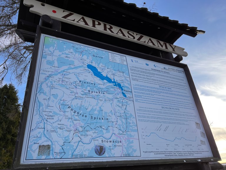
Na polanę i do kapliczki na Przełęczy nad Łapszanką możesz dojść również pieszo szlakami:
Szlakiem żółtym ze wsi Łapsze Niżne – 8 kilometrów.
Szlakiem niebieskim z Kacwina – 10 kilometrów.
Szlakiem niebieskim z Rrzepiska – 3,7 km.
Szlakiem czerwoną z Bukowiny Tatrzańskiej – 6,7 km.
Szlakiem czerwoną z Jurgowa – 5,3 km.
You can also reach the clearing and the chapel on the Mountain Pass over Lapszanka on foot via trails:
The yellow trail from the village of Łapsze Niżne - 8 kilometers.
The blue trail from Kacwin - 10 kilometers.
The blue trail from Rrzepisko - 3.7 kilometers.
The red trail from Bukowina Tatrzańska - 6.7 kilometers.
The red trail from Jurgow - 5,3 kilometers.
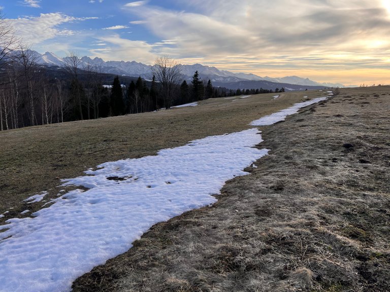
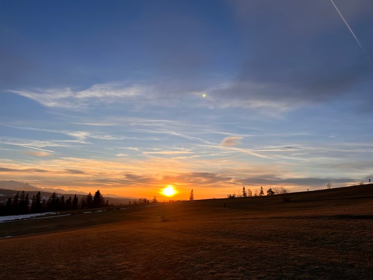
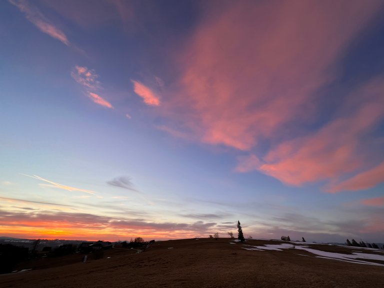
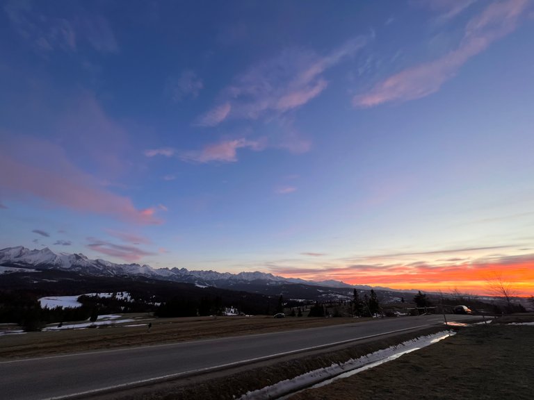
Zachód był długi, a słonce powoli przesuwało się po widnokręgu. Na miejscu pojawiało się z każdą chwilą coraz więcej miłośników fotografii. Pogoda i widoczność rzeczywiście sprzyjała robieniu zdjęć.
The sunset was long and the sun was slowly moving across the sky. With each passing moment, more and more photography enthusiasts appeared in the clearing. The weather and visibility were really conducive to taking photos.
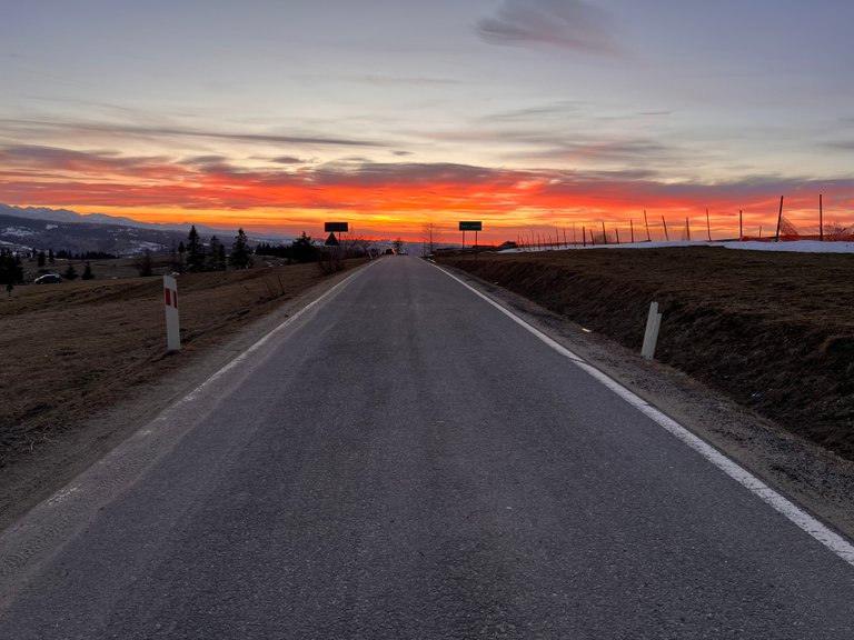
Kiedy zrobiło się już całkiem ciemno, przyszła pora na powrót z tego malowniczego, pięknego polskiego zakątka natury.
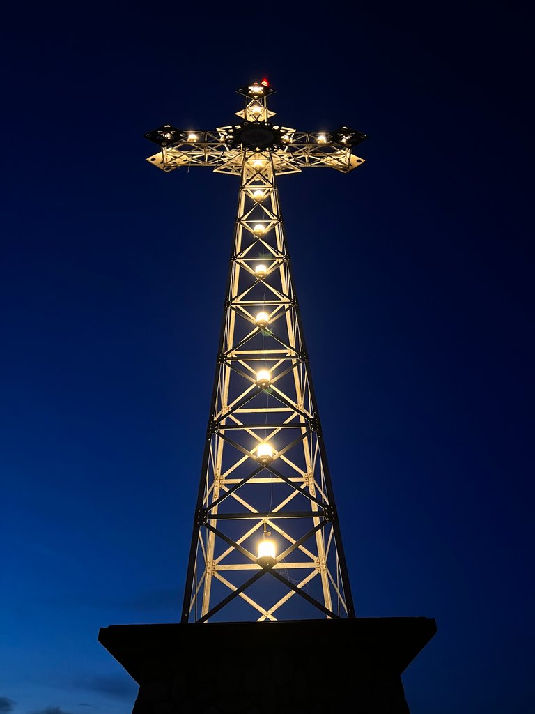
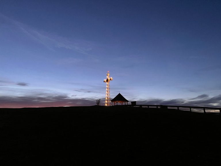
Wracając drogą w kierunku Białki Tatrzańskiej, zauważyliśmy w oddali świecący krzyż na wzniesieniu. Widzieliśmy go już kilka miesięcy wcześniej, kiedy wracaliśmy tą samą trasą ze Słowacji. Już wtedy nas zaciekawiło, gdzie on jest. Postanowiliśmy tym razem to sprawdzić.
When it became quite dark, it was time to return from this picturesque, beautiful Polish corner of nature.
Returning along the road toward Bialka Tatrzanska, we noticed a glowing cross on a hill in the distance. We had already seen it a few months earlier, when we were returning along the same route from Slovakia. Even then we were curious about where it was. We decided to check it out this time.
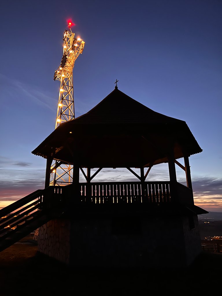
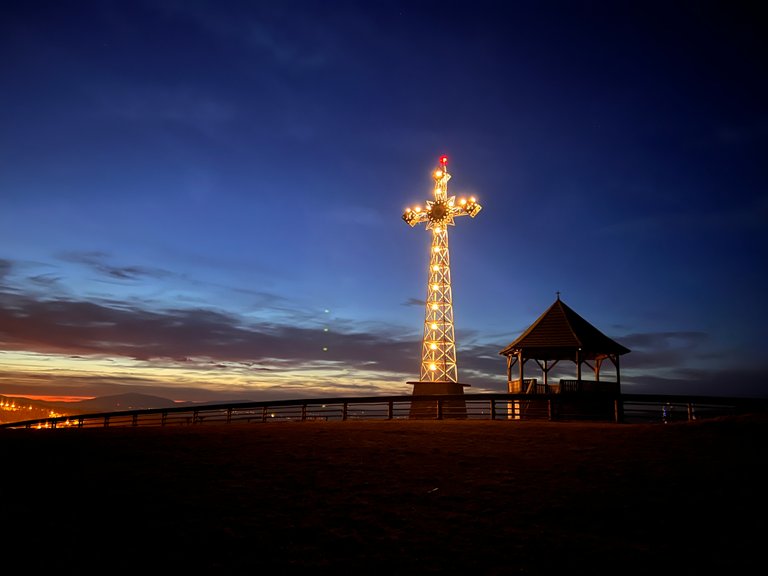
Krzyż Milenijny
Aby dojechać na szczyt, należy się kierować na Czarną Górę, a następnie w górnej części wsi skręcić, w wąską, stromą asfaltową drogę, ze znakiem nakazu zakładania łańcuchów w okresie zimowym.
Współrzędne geograficzne: 49.3812, 20.1249.
Szczyt góry ma naprzemiennie używane nazwy. Czarna Góra, Litwinka lub Litwińska Grapa (902 m n.p.m.). Na szczycie Litwinki stoi 20-metrowy Krzyż Milenijny, który został wybudowany w 2000 roku dzięki staraniom księdza proboszcza Czarnej Góry ks. Huberta Kasztelana dla uczczenia dwóch tysiącleci chrześcijaństwa. Krzyż został wykonany na wzór krzyża na szczycie Giewontu.
## Millennium Cross
To reach the summit, head for Czarna Gora and then turn at the top of the village, onto a narrow, steep asphalt road, with a sign ordering the wearing of chains in winter.
Geographical coordinates: 49.3812, 20.1249.
The top of the mountain has alternate names. Czarna Gora, Litwinka or Litwinska Grapa (902 meters above sea level). On top of Litwinka stands a 20-meter high Millennium Cross, which was built in 2000 thanks to the efforts of Czarna Gora parish priest Hubert Kasztelan to commemorate two millennia of Christianity. The cross was made on the model of the cross on top of Giewont.
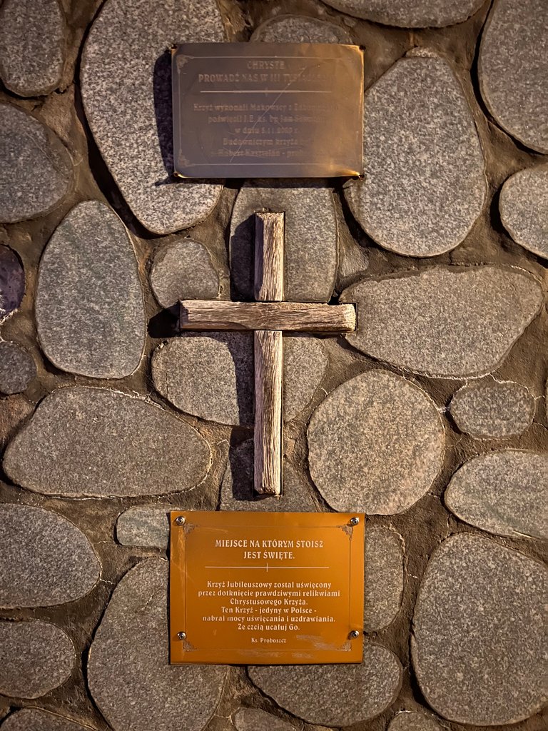
Na tabliczce u podnóża krzyża widnieje napis:
„MIEJSCE NA KTÓRYM STOISZ JEST ŚWIĘTE. Krzyż jubileuszowy został uświęcony przez dotknięcie prawdziwymi relikwiami Chrystusowego Krzyża. Ten Krzyż – jedyny w Polsce – nabrał mocy uświęcania i uzdrawiania. Ze czcią ucałuj go. Ks. Proboszcz.”
The plaque at the foot of the cross reads:
"THE PLACE ON WHICH YOU STAND IS SACRED. The Jubilee Cross has been sanctified by touching the real relics of Christ's Cross. This Cross - the only one in Poland - has acquired the power to sanctify and heal. With reverence kiss it. Rev. Pastor."
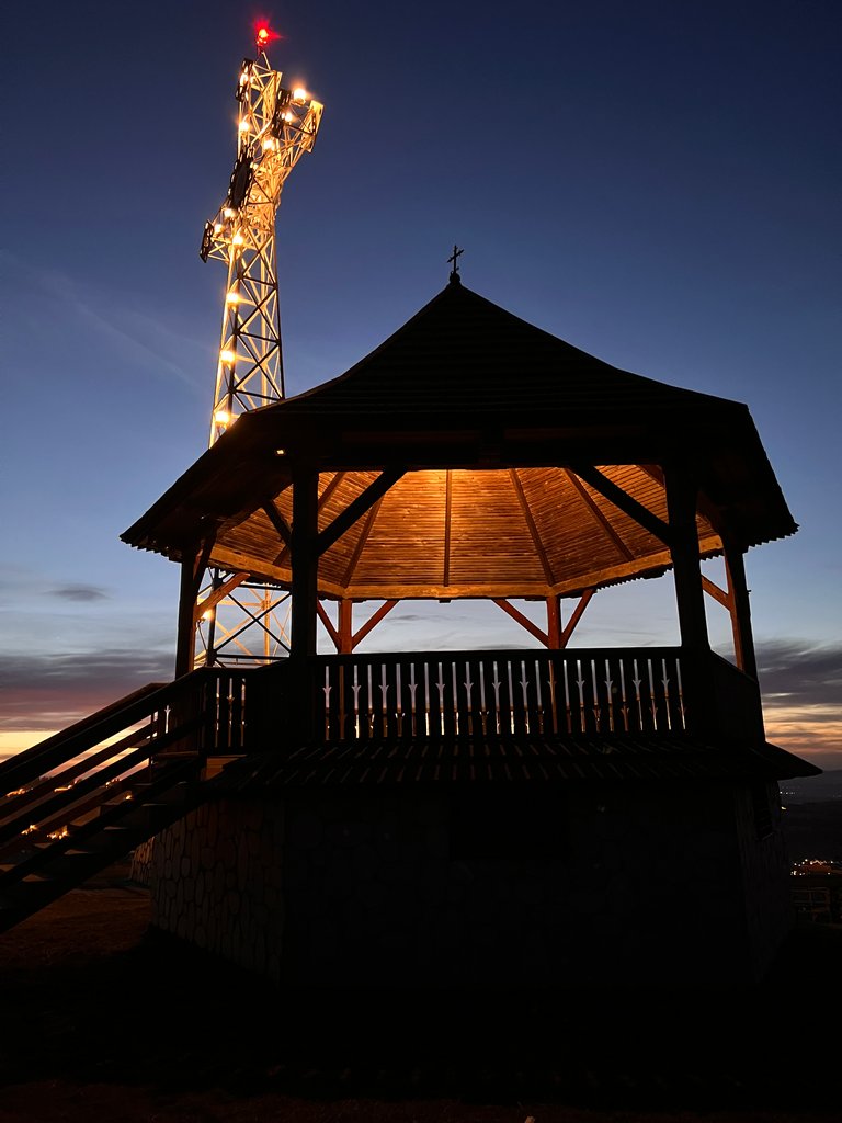
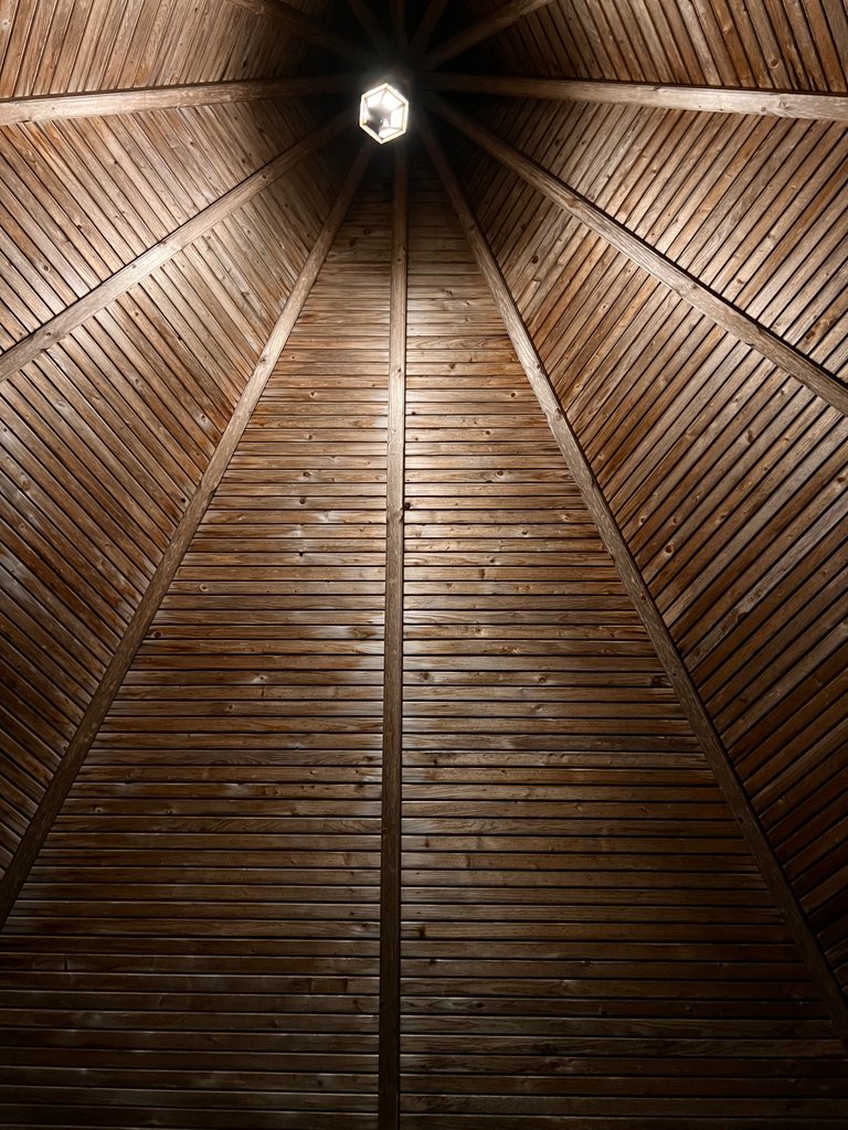
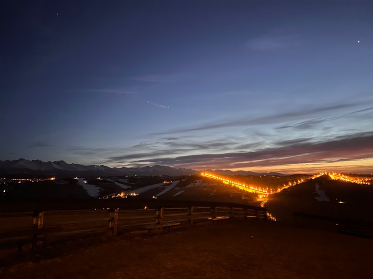
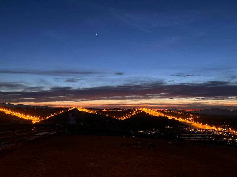
Tuż obok krzyża stoi kamienno-drewniana zadaszona altana widokowa. My dotarliśmy tam już nocą, zwabieni blaskiem krzyża jednak za dnia można z tego punktu widokowego podziwiać panoramę Tatr, Podhala, Gorców oraz Pienin. My w nocnym spektaklu mogliśmy natomiast podziwiać iluminacje świetlne dobiegające ze stoków narciarskich.
Right next to the cross stands a stone and wooden covered viewing gazebo. We got there at night, lured by the glow of the cross, but during the day you can admire the panorama of the Tatra Mountains, Podhale, Gorce and Pieniny from this vantage point. We, on the other hand, could admire the illuminations coming from the ski slopes at night.
Był to bardzo owocny i miły dzień. Myślę, że częściej będę korzystał z mojej listy miejsc widokowych, do których można dojechać samochodem.
It was a very fruitful and pleasant day. I think I will use my list of scenic spots that can be reached by car more often.
Dziękuję za przeczytanie! Miłego dnia.
Thank you for reading and good day for everyone!
Wszystkie zdjęcia są mojego autorstwa. Zostały wykonane iPhone 13 pro max bez użycia filtrów.
All photos are by me. They were taken with iPhone 13 pro max without using filters.