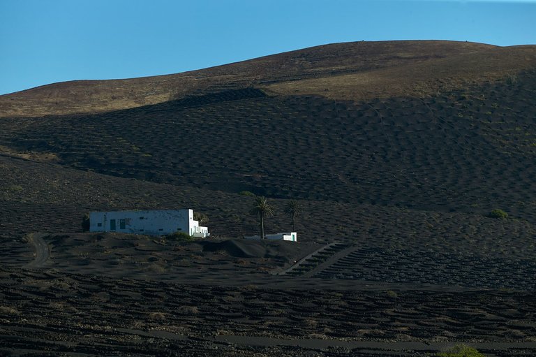
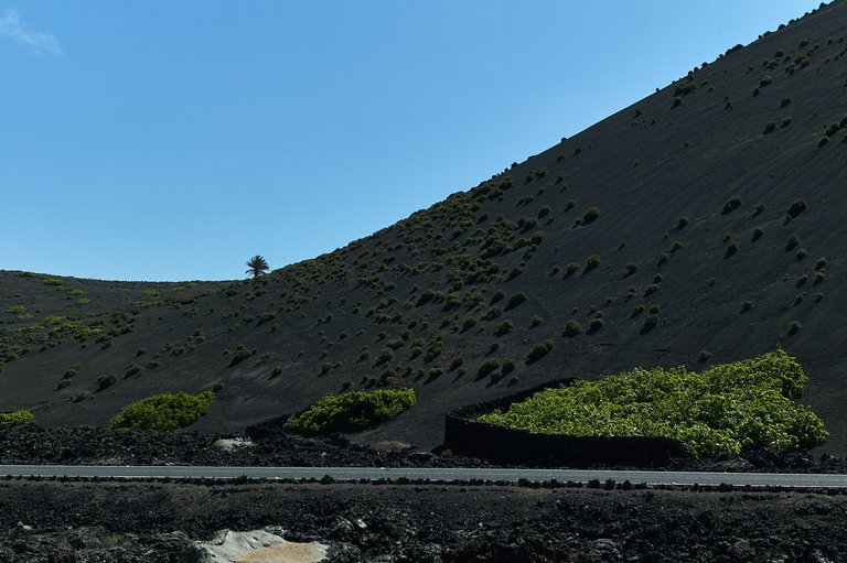
Lanzarote is the easternmost island of the Canary archipelago, the one closest to the African continent. It is a volcanic island and in geological terms, of recent activity, the last eruptions took place at the end of the 18th century and these completely changed the landscape of the southern half of the island, devastating everything. Little by little, the patience and good work of the locals managed to turn the immense lava fields into places of cultivation, especially of fig trees and vines. The hand of man even turned the slopes of the extinct volcanoes into fertile areas that provided the basic foodstuffs for survival.
ESP
Lanzarote es la isla más al este del archipiélago canario, la que está más cerca del continente africano. Es una isla volcánica y en términos geológicos, de reciente actividad, las últimas erupciones se produjeron a finales del siglo XVIII y estas cambiaron completamente el paisaje de la mitad sur de la isla, devastándolo todo. Poco a poco la paciencia y buen hacer de los locales consiguieron hacer de los inmensos campos de lava, lugares de cultivo, especialmente de higueras y viñas. La mano del hombre convirtió incluso las laderas de los extintos volcanes en fértiles espacios que proporcionaban los alimentos básicos de supervivencia.
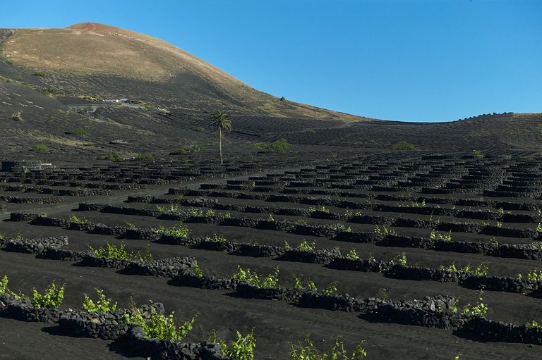
Here we may see a couple of instances of one of this volcano' slopes that became in a vineyard. Each tree is protected by a small stone wall to prevent wind erosion.
*Aquí un par de ejemplos del cultivo en la falda de un volcán convertido en una viña. Cada árbol está protegido por una pequeña pared de piedra para evitar la erosión del viento.
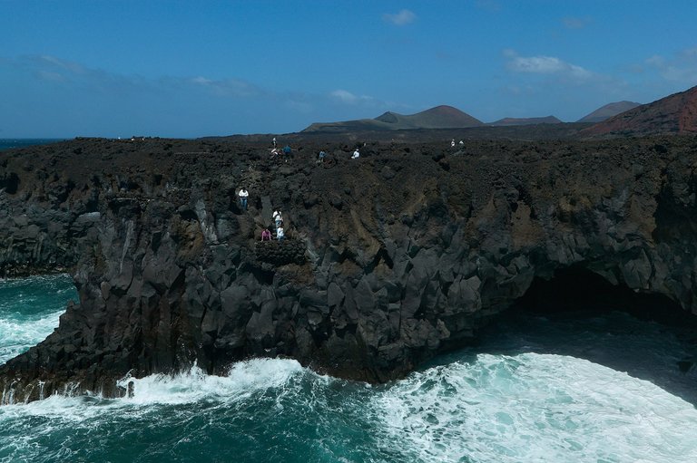
At the southern tip of the island, when the boiling lava touched the water of the Atlantic Ocean, it formed these bizarre rock formations. In the picture, small volcanic stone balconies, the work of the famous Lanzarote architect César Marique, allow you to get close to the interior of these natural sculptures.
En el extremo sur de la isla, cuando la lava hirviente tocó el agua del Océano Atlántico, formó estas extrañas formaciones rocosas. En la imagen, pequeños balcones de piedra volcánica, obra del insigne arquitecto lanzaroteño César Manrique, permiten acercarse al interior de estas esculturas naturales.
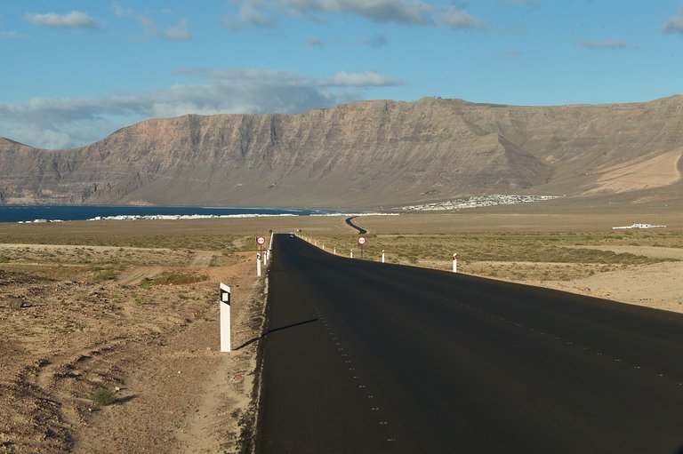
In the northern half, the landscape is clearer, but the volcanic origin of the island is still evident. The dunes of Caleta de Famara with its impressive cliff closing the gulf.
ESP
En la mitad norte, el paisaje es más claro, pero sigue patente el origen volcánico de la isla. Las dunas de la Caleta de Famara con su risco imponente cerrando el golfo.
Finally, another image of the region of La Geria, with its impossible crops between the last active volcanoes.
ESP
Por último otra imagen de la comarca de La Geria, con sus cultivos imposibles entre los últimos volcanes activos
Unless stated otherwise, all the pictures and the words are mine.
Do not use this image without my written permission.
Proudly free of AI.
Thanks for stopping by and taking a look.
Camera: Canon EOS5 MK III
Lens: Canon 24-70 f:2.8
Processed with Capture One